World-class training for the modern energy industry

Introduction to Log Analysis and Petrophysical Characterization (G104)

Tutor(s)

Joe Landry: President, Petrophysical Solutions Inc.

Overview

This course will review basic interpretation techniques from conventional logs with a focus on key reservoir properties.

Duration and Logistics

Classroom version: A three-day classroom course comprising a mixture of lectures and exercises. The course manual will be provided in digital format.

Level and Audience

Fundamental. This course is designed for those without any experience or familiarity with logs.

Objectives

You will learn to:

  1. Introduction and review of key rock properties and terminology used.
  2. Understand the wellbore environment and how this can affect the data acquired.
  3. Review data types and acquisition technologies.
  4. Understand log types and evaluate appropriate display scales.
  5. Evaluate and QC log data.
  6. Review the Archie equation and how it is used to determine water saturation.
  7. Understand the limitations and pitfalls of the described interpretation techniques particularly with respect to deepwater reservoirs in the Gulf of Mexico.
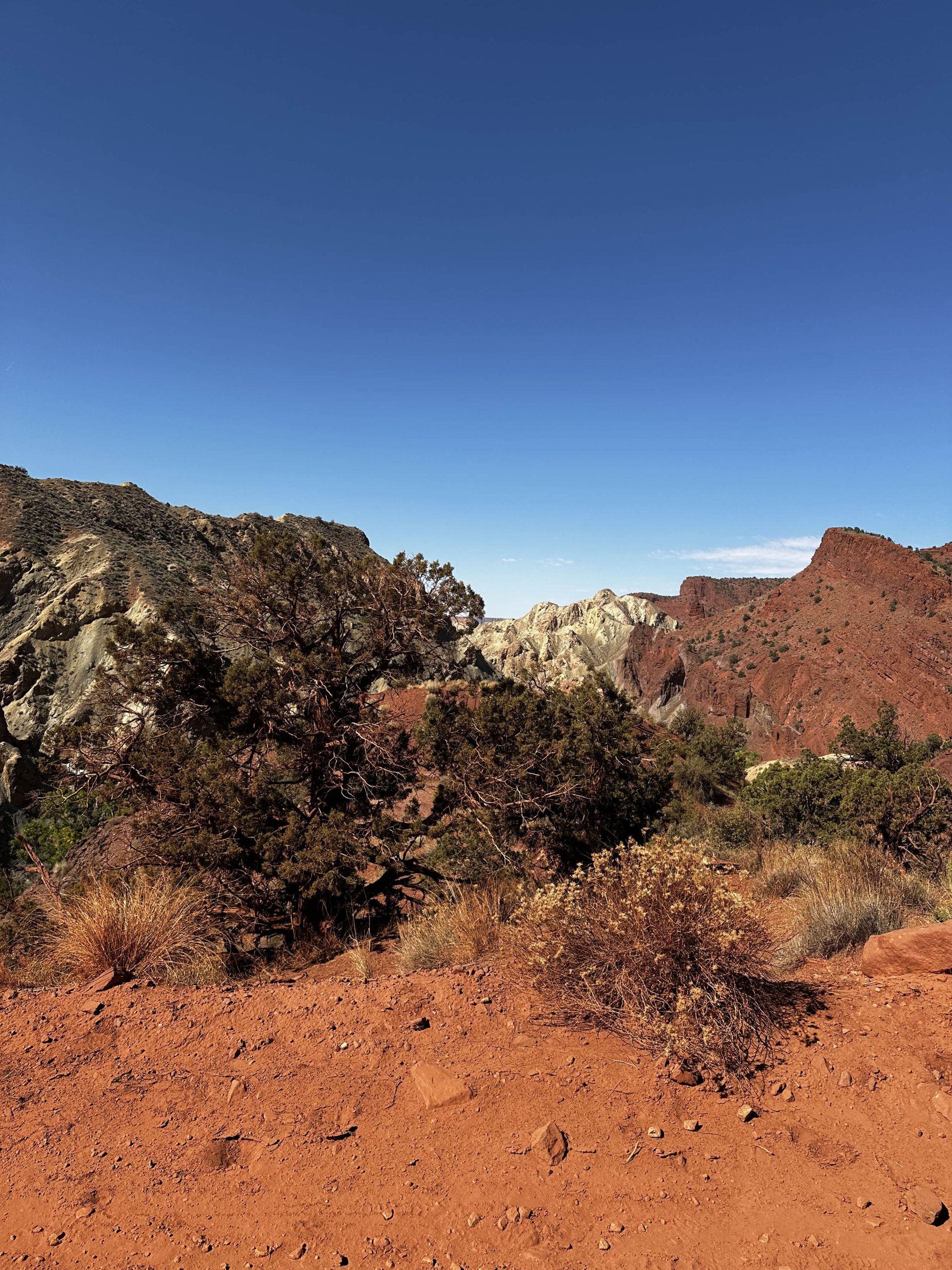
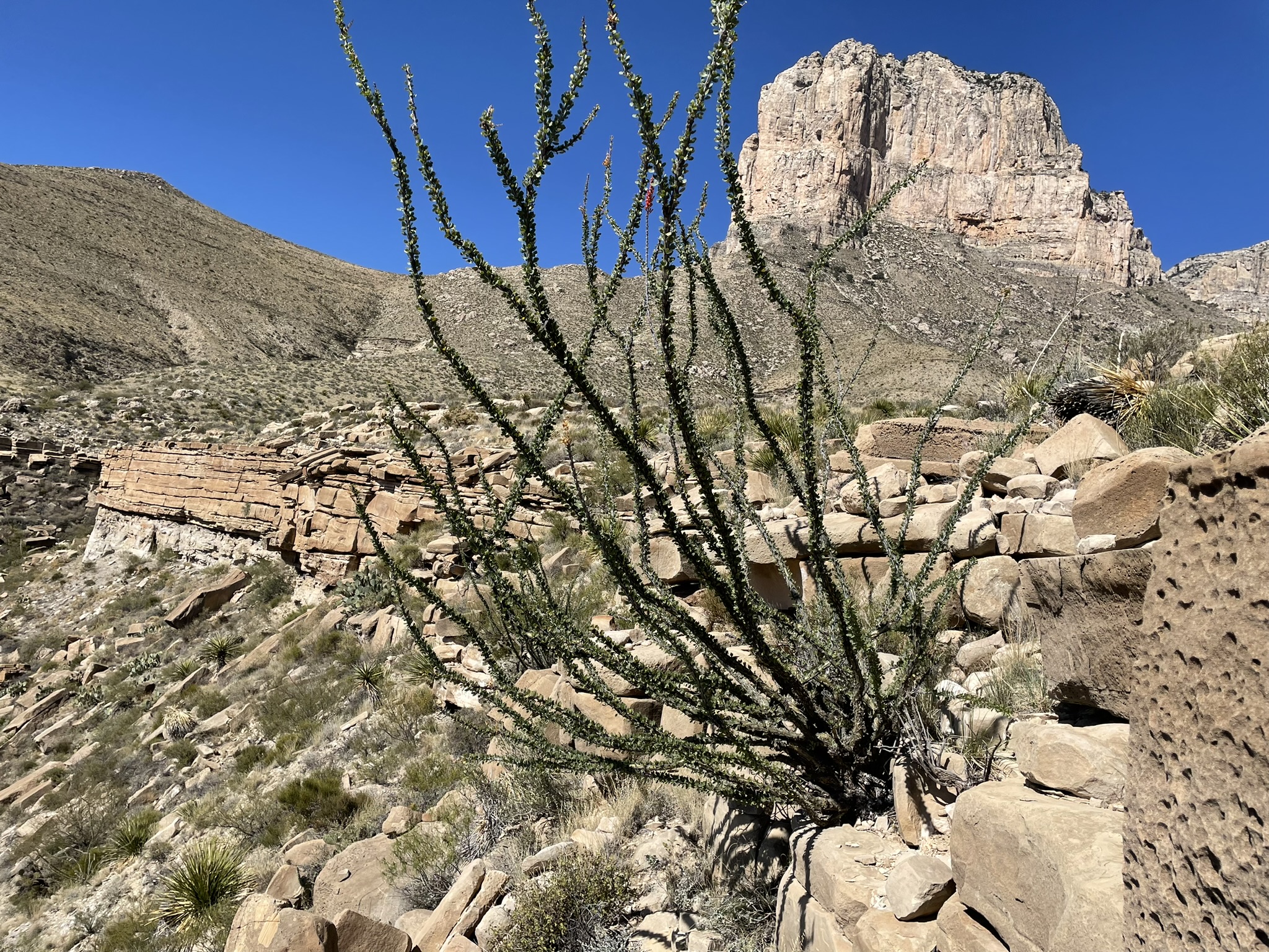
The Geology of the Paradox Basin and Implications for Deepwater Gulf of Mexico Exploration, Moab, Utah (G095)

Tutor(s)

Kate Giles: Lloyd A. Nelson Professor, University of Texas at El Paso; Consulting Geologist.

Overview

The primary technical goal is to provide a widely applicable introduction to the interrelationship between sedimentation and structural geology with a particular focus on salt tectonics and salt-sediment interaction. The geology is examined with reference to deepwater exploration themes with the Gulf of Mexico.

Duration and Logistics

A 4-day field course starting and finishing in Grand Junction, Colorado, comprising a mixture of lectures, field work and exercises.

Level and Audience

Intermediate. This course requires a basic understanding of geoscience and will suit those working in the geoscience, geotechnical and engineering fields. The aim is to facilitate knowledge and experience exchange among the participants, so is open to those from a very wide range of experience levels.

Exertion Level

This course requires a MODERATE exertion level. There will be hikes to outcrops of up to 6.5km (4 miles) round trip. Some of these will encounter uneven and rocky ground with some short, steep inclines. The climate in southern Utah is typically warm to hot and dry with temperatures up to 37.5°C (100°F) and the elevation is between 1,250–1,500m (4,000–5,000 ft).

Objectives

You will learn to:

  1. Describe the regional stratigraphy and principal structural features of the Paradox Basin, Utah.
  2. Characterize and interpret controls on Paradox Basin salt-related structures and key features of passive diapiric systems, including halokinetic sequences, caprock development, non-evaporite stringers / inclusions, welds, megaflaps, counter-regional faults, radial faults and burial wedges.
  3. Examine stratal geometries and halokinetic sequences and how these relate to intervals of salt inflation / evacuation and sediment flux.
  4. Assess the controls on basin fill architecture, fluid flow and deformation within the Paradox Basin and compare this to analogous salt basins worldwide.
  5. Understand the importance of salt basins to the energy industry for hydrocarbon production.

Slope-Channel Depositional Systems: Brushy Canyon Formation, SE New Mexico and West Texas​ (G091)

Tutor(s)

Art Saller: Independent Geological Consultant.

Overview

This field course is designed for geoscientists and engineers exploring and developing deepwater clastic reservoirs anywhere in the world. The course examines excellent (classic) exposures showing depositional facies and stratal geometries developed in deepwater slope and channel environments and their controls on reservoir presence, quality and production. Outcrop description and exercises with subsurface data are integrated into the course. Analog fields from West Africa, Gulf of America/Mexico, southeast Asia and the Permian Basin are discussed on outcrops.

Duration and Logistics

A 6-day field course beginning and ending in El Paso, Texas. Most training will take place through observation and discussion in the field.

Level and Audience

Advanced. The course is aimed at geoscientists, petrophysicists, reservoir engineers and production engineers working deepwater siliciclastic reservoirs. Basic principles are presented on the first morning to bring participants to a common level of understanding. Outcrop viewing, description and exercises will give even advanced level participants improved understanding of these systems.

Exertion Level

This class requires a DIFFICULT exertion level. The outcrops are in west Texas and southeast New Mexico, where the weather is arid with hot summers and cool winters. This trip is run in spring or fall when temperatures are more moderate, although hot, cold or wet weather is possible. Daily temperatures can range from 5–30°C (40–90°F). The course includes a hike of around 6 km/4 miles with an ascent of 400m (1300 ft), and shorter hikes, frequently over very steep and uneven ground. Transport on the course will be by coach. Most of the driving is on black-top roads, with some driving on graded dirt roads.

Objectives

You will learn to:

  1. Visualize the seismic-scale geometries of major slope channel systems including incised upper slope valleys, amalgamated mid-slope channel-complexes, and middle to lower slope channel-levee complexes for use in subsurface interpretation.
  2. Assemble a predictive model for those different sand geometries relative to slope position.
  3. Describe different deep-water (turbidite) facies and understand variations in their distribution and reservoir characteristics in different architectural elements (channel, levees, splays).
  4. Relate outcrop and core scale variations of deepwater sands to wireline log characteristics within channel complexes to help interpret facies in logs.
  5. Predict how turbidites and their characteristics change laterally which can be applied to static and dynamic reservoir models for appraisal and development.
  6. Assess thin turbidite sand beds and understand where they occur deep-water systems and how their continuity can vary from relatively limited areal continuity in levees to sheets in thin-bedded basin floor fans.
  7. Evaluate variation in grain size and lateral continuity of sand bodies, understand why they can cause large variations in permeability, production rates and oil recovery.
  8. Relate characteristic of outcrops to analogous oil fields along the West African margin, Gulf of America/Mexico, southeast Asia and the Permian Basin
 

Understanding Seismic Data: Time, Depth and Geology (G082)

Tutor(s)

David Kessler: President, SeismicCity Inc.

Ron Kerr: Seismic Processing Consultant.

John Byrd: President, ByrdGEO; Adjunct Professor of Geology, University of Utah.

Overview

This course is designed to provide seismic interpreters, managers, geophysicists and geologists with a broad understanding of seismic imaging and processing. Emphasis will be placed on an understanding of industrial methods and workflows, differentiation of signal from artifacts, and connecting seismic data to geological settings for prospect evaluation and generation. The limited amount of quantitative seismic theory that is included is linked to the fundamentals of seismic data acquisition and processing, imaging, model building and interpretation through the incorporation of case studies. The eight course sessions continually build on the material from previous sessions and are tied to the underlying geology.

Duration and Logistics

A 4-day in-person classroom course, consisting of lectures and exercises. A digital manual will be provided for the course.

Level and Audience

Intermediate. The course is intended for seismic interpreters and geologists involved in the use and evaluation of seismic data.

Objectives

You will learn to:

  1. Outline the principal strengths and limitations of depth imaging.
  2. Assess the uncertainties of depth imaging and strategies to reduce these.
  3. Establish the fundamentals of marine- and land-based seismic from acquisition to pre-processing.
  4. Examine the processing steps leading to post- and pre-stack time migration, and post-stack depth migration.
  5. Evaluate various migration parameters used in the application of pre-stack depth migration and how they affect the PSDM image.
  6. Gauge the accuracy of time to depth conversion by application of pre-stack depth migration, as well as seismic to well tie and residual depth correction.
  7. Demonstrate the fundamental differences between depth and time migration and the improved imaging results when depth migration is utilized to resolve lateral velocity variations.
  8. Evaluate the link between the pre-stack depth image and the underlying geological settings.
  9. Analyze the complex structural geometries associated with salt tectonics and their significant associated imaging challenges.
  10. Differentiate signal from artifacts.
  11. Assess the construction of geological models utilizing our common understanding of velocity estimation, anisotropic parameters and different geologic settings.
  12. Connect seismic data to geological settings for prospect evaluation and generation.

Carbonate Depositional Systems: Reservoir Sedimentology and Diagenesis (G105)

Tutor(s)

Paul Wright: Independent Consultant.

Overview

This course is aimed at those with little or no previous experience with carbonate rocks as reservoirs or aquifers. A broad introduction to carbonate systems is presented, with multiple case examples interspersed throughout the course, in order to illustrate the different types of carbonate deposition, stratigraphy and diagenesis. Besides reviewing the essential components and origins of such rocks, it also illustrates how key characteristics are identified from seismic data and the issues relating to flow behaviour. Participants will attain a broad understanding of carbonate rocks – their components, depositional models and diagenetic variation – to better assist in the prediction of carbonate reservoirs from seismic to pore scale.

Duration and Logistics

Classroom: A 4.5-day in-person classroom course. Digital course notes and exercise materials will be distributed to participants before the course.

Virtual version: Nine 3.5-hour interactive online sessions. Digital course notes and exercise materials will be distributed to participants before the course.

Level and Audience

Fundamental. The course is intended for geoscientists (geologists and geophysicists) and petroleum engineers with little or no experience of carbonate reservoirs.

Objectives

You will learn to:

  1. Understand and describe the principal carbonate sediment components and systems of carbonate classification.
  2. Describe the primary controls on carbonate deposition temporally and spatially, and discuss the contrasts between the controls on siliciclastic deposition.
  3. Describe the main types of carbonate platform, their variability, scale, main seismic features and distribution of likely reservoir units.
  4. Demonstrate sequence stratigraphic aspects of carbonate build-ups, their differing response to SL change compared to clastic sediments and discuss their seismic characters.
  5. Review principal types of likely reservoir facies (platform interior, carbonate sands, reefs, slope systems and chalks), their recognition, architecture, sequence stratigraphy and porosity types.
  6. Identify the diverse pore types in carbonates and how these relate to reservoir quality.
  7. Understand how the development of primary and secondary porosity has varied through geological time and how these changes impact reservoir quality.
  8. Explain how the variety of diagenetic environments affects primary and secondary porosity in carbonate rocks and understand the implications for reservoir quality.
  9. Understand the uses of the main techniques for deciphering diagenetic sequences in carbonates.
  10. Discuss the principal modes of formation of dolomites and the predictive uses of different dolomite models.
  11. Understand the diverse origins of palaeokarstic macroporosity, its subsurface recognition, and different strategies for developing palaeokarstic systems for geothermal energy and hydrocarbon reservoirs.

Sand-rich and Confined Turbidite Systems: Annot, France (G048)

Tutor(s)

Mark Bentley: TRACS International Consultancy and Langdale Geoscience.

Overview

Experience the classic, well-exposed Grès d’Annot turbidite outcrop area in the French Alps, an excellent analogue for deepwater exploration and development targets in structurally active slope and basin settings. This course will provide insights into field development challenges in relatively confined, high-net, submarine fan systems by using the world-class exposures along with static/dynamic models of the outcrops to support discussions. Seismic forward-models of 3-D and 4-D responses to waterfloods in these systems add to the conversation. The setting allows reservoirs to be observed at a range of scales from seismic- and field-scale, to the scale of a core plug, and is intended for a cross-discipline, geoscience and petroleum engineering audience.

Duration and Logistics

A 7-day field course in the French Alps, comprising field activities and exercises on-site, unless weather doesn’t allow. The manual will be provided in paper format, with a digital copy available as a take-away.

Level and Audience

Advanced. The course is designed for integrated teams (geologists, geophysicists and reservoir engineers) evaluating development opportunities for fields in deepwater confined basins. The ideal group would be an asset team, who would be encouraged to bring their own field issues (and data where possible) to discuss live on the analogue.

Exertion Level

This class requires a DIFFICULT exertion level. The Grès d’Annot is quite comfortable in the early summer, with temperatures of 10–25°C (50–80°F) and occasional rain showers. Some field locations require path-based hillwalking involving ascents up to 600m (2000 feet). The longest excursion involves a full-day hike and will be conducted at a leisurely pace.

Objectives

You will learn to:

  1. Assess discrete, structurally controlled sediment transport pathways into bathymetrically complex deepwater basins.
  2. Assess the role of relative structural and flow confinement on turbidite reservoir architecture.
  3. Characterize internal reservoir architecture in different parts of the system and assess the impact of heterogeneities on fluid flow.
  4. Formulate reservoir and simulation modelling requirements, in order to forecast production performance from reservoirs of these types.
  5. Determine the level of detail required for reservoir characterization under a range of fluid fills and production mechanisms.
  6. Understand how much of the observed heterogeneity would be detectable on seismic, and predict how fluid-sensitive heterogeneities would be visible on 4-D seismic for a field on production.

Integration of Rocks and Petrophysical Logs (G059)

Tutor(s)

Greg Samways: Director, Geolumina.

Overview

This course will focus on a simple petrophysical workflow entailing the determination of rock properties from conventional logs and core analysis data. Lithology, porosity, permeability and saturations will be determined using a variety of different analytical and simple modelling methods. Emphasis will be placed on understanding the importance of calibration, integration, and validation of the results of each method, based on a fundamental understanding of the geological controls on petrophysical properties.

Duration and Logistics

Classroom version: 3-days with a mix of lectures and exercises. The manual will be provided in digital format and participants will be required to bring a laptop or tablet computer to follow the lectures and exercises.

Virtual version: Five, 3.5-hour interactive online sessions presented over 5 days. The course will focus on problem-solving using real-world data and use a series of Excel workbooks. A digital manual and exercise materials will be distributed to participants before the course.

Level and Audience

Fundamental. This course is intended for non-petrophysicists who require a grounding in the petrophysical determination of lithology, porosity and saturation from conventional and special core analysis, and conventional open-hole logs.

Objectives

You will learn to:

  1. Understand the fundamental geological controls on reservoir properties.
  2. Describe how these properties are measured in the laboratory using conventional and special core analysis methods.
  3. Characterize the ways in which lithology and porosity are determined from well logs and calibrated with core analysis, and how permeability may be estimated in the subsurface away from core control.
  4. Evaluate how the Archie equation is used to determine saturation in cores and from well logs, and the uncertainties and limitations with this method
  5. Investigate how saturation-height models can be created from special core analysis data, thereby avoiding some of the limitations of the Archie method.
  6. Interpret typical conventional log and core analysis data using Excel spreadsheets.
  7. Experiment with the sensitivities of input parameters for various determinations, such as V-Shale, porosity and saturation.

Building a Reservoir Model, Pembrokeshire, UK (G055)

Tutor(s)

Mark Bentley: TRACS International Consultancy and Langdale Geoscience.

Overview

This course offers a software-independent view on the process of reservoir model design and simulation model-building, addresses the underlying reasons why some models disappoint and offers solutions that support the building of more efficient, fit-for-purpose models. The thread through the week is a model design for the notional ‘Pembroke Field’ – a synthetic field constructed from reservoir analogue outcrops in South Pembrokeshire.  The Pembroke Field contains three contrasting reservoir types: continental clastics, shallow marine deltaics and naturally fractured carbonates, in both structurally deformed and undeformed settings. Data from producing oil and gas fields has been scaled to the synthetic models to create a realistic hydrocarbon field accumulation, ready for development.

Objectives

You will learn to:

  1. Create a fluid-sensitive conceptual model for a heterogeneous reservoir, built from a selection of elements and placed in a realistic architectural framework: the “sketch”.
  2. Guide the use of geostatistical tools intuitively, balancing deterministic and probabilistic components with awareness of the limits of the tools.
  3. Select appropriate methods for modeling of matrix properties, including the handling of net (cut-off’s vs total property modeling).
  4. Evaluate options for multi-scale modelling and the possible need for multi-scale approaches based on hierarchical understanding of Representative Elementary Volumes (REV).
  5. Understand issues surrounding permeability modeling and why this differs from the handling of other properties.
  6. Learn a rule of thumb (“Flora’s rule”) to help assess what level of static model detail matters to flow modeling and forecasting.
  7. Review how to use well test analysis to constrain models.
  8. Review options for model-based uncertainty handling (base case led, multi-deterministic scenarios, multi-stochastic ensembles), learn how to post-process the results and how to select an appropriate workflow which minimizes impact of behavioral bias.

Exertion Level

This class requires an EASY exertion level. Field stops require short walks along coastal paths, beaches and wave cut platforms. The longest walk is <5km (3 miles). Field stops are all at approximately sea level and some are tide dependent. Transport will be by coach.This class requires an EASY exertion level. Field stops require short walks along coastal paths, beaches and wave cut platforms. The longest walk is <5km (3 miles). Field stops are all at approximately sea level and some are tide dependent. Transport will be by coach.

Level and Audience

Intermediate. The course is aimed at geoscientists with knowledge of reservoir modeling software, petrophysicists who provide input to static reservoir models and reservoir engineers involved in simulation work who deal with the static-dynamic interface on a regular basis. The course is also of benefit to team leaders who wish to have a deeper understanding of the principles behind modeling and how to QC models made by others.

Duration and Logistics

7 days; a mix of field work (70%), and classroom exercises (30%).

Essential Data Science for Subsurface Geoscientists and Engineers (G065)

Tutor(s)

David Psaila: Director of Data Science for the Digital Subsurface, Analytic Signal Limited.

Overview

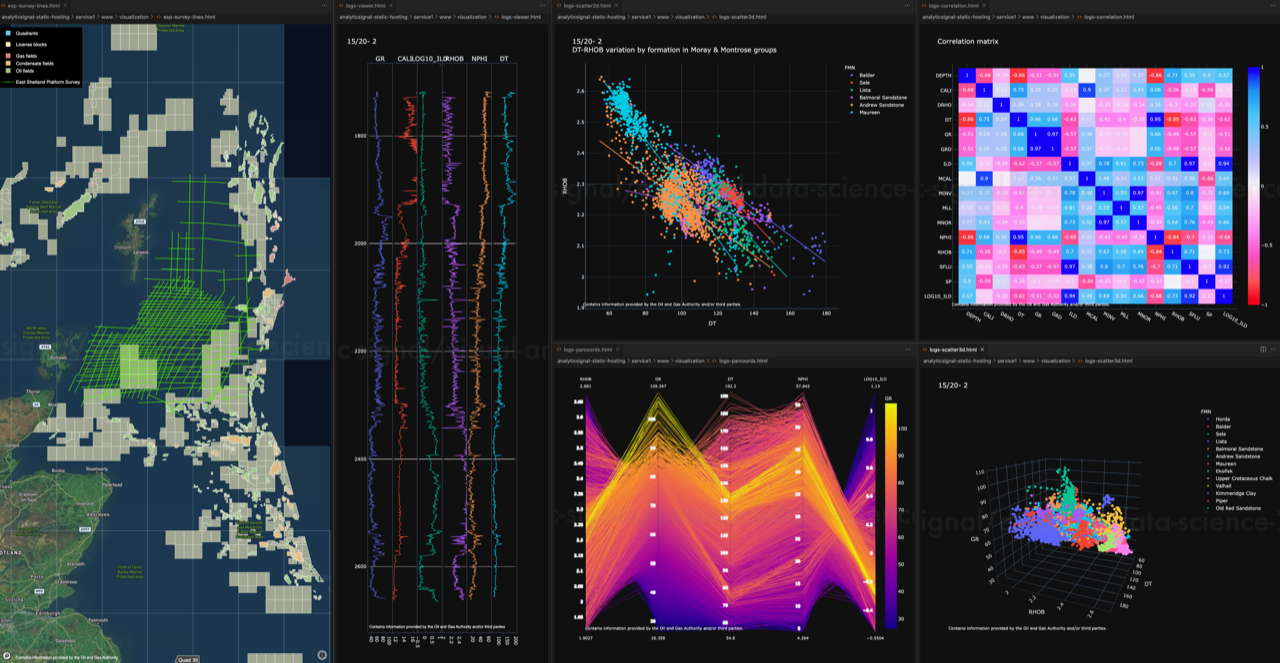
Interest in data science and machine learning is rapidly expanding, offering the promise of increased efficiency in E&P, and holding the potential to analyse and extract value from vast amounts of under-utilised legacy data. Combined with petroleum geoscience and engineering domain knowledge, the key elements underlying the successful application of the technology are: data, code, and algorithms. This course builds on public datasets, code examples written in Python, statistical graphics, and algorithms from popular data science packages to provide a practical introduction to the subject and its application in the E&P domain.

Duration and Logistics

Classroom version: 5 days consisting of lectures and computer-based exercises and practicals.

Virtual version: Ten, 3-hour online sessions presented over 5 days. The course is at an introductory level and all subject matter will be taught from scratch. No prior experience of statistics, Python coding or machine learning is required, although some basic college level knowledge of maths and statistics is useful. Hands-on computer workshops form a significant part of this course, and participants must come equipped with a laptop computer running Windows (8, 10, 11) or MacOS (10.10 or above) with sufficient free storage (4 Gb). Detailed installation instructions are provided in advance so that participants can set up their computer with the data science toolkit and course materials before the course starts.

Level and Audience

Fundamental. This is an introductory course for reservoir geologists, reservoir geophysicists, reservoir engineers, data management, and technical staff who want to learn the key concepts of data science.

Objectives

You will learn to:

  1. Analyse project data using the data science toolkit; notebooks, visualization, and communication.
  2. Perform data import and manipulation, data visualization, exploratory data analysis, and building predictive models from data.
  3. Have a working knowledge of coding in Python.
  4. Coordinate reference systems including geographic and projected coordinate systems.
  5. Use the fundamentals of machine learning including background concepts, the different types of machine learning, and the basic workflow to build and evaluate models from data.

An Introduction to Sequence Stratigraphy (G068)

Tutor(s)

Gary Hampson: Professor of Sedimentary Geology, Imperial College London.

Overview

Sequence stratigraphy is a key tool for subsurface interpretation of depositional systems and thereby predicting the distribution of reservoir, source rock and seal lithologies. The course will introduce the principles and methods of sequence stratigraphy, with a focus on continental, shallow-marine and deep-marine depositional settings. Participants will apply these principles and methods via the sequence stratigraphic interpretation of subsurface data (e.g. seismic, well-log, core, reservoir production data).

Duration and Logistics

Classroom version: 2 days including a mix of lectures and exercises. The course manual will be provided in digital format and participants will be required to bring along a laptop or tablet to follow the lectures and exercises.

Virtual version: Three 3.5-hour interactive online sessions presented over 3 days. A digital manual will be distributed to participants before the course.

Level and Audience

Fundamental. This course is designed for junior geoscientists working on a variety of subsurface energy projects who want to gain a basic understanding of sequence stratigraphy and its applications to subsurface data sets. Participants should have knowledge of basic sedimentology and subsurface geology.

Objectives

You will learn to:

  1. Understand the basic terminology of sequence stratigraphy.
  2. Describe the key surfaces and systems tracts.
  3. Appreciate the main components of depositional sequences in continental, shallow-marine and deep-marine systems.
  4. Evaluate a range of subsurface data in terms of sequence stratigraphic methods and models.