World-class training for the modern energy industry

Reservoir Characterization for Carbon Capture and Underground Storage, Devon and Dorset, UK (G556)

Tutor(s)

Gary Hampson: Professor of Sedimentary Geology, Imperial College London.

Matthew Jackson: Chair in Geological Fluid Dynamics, Imperial College London.

Overview

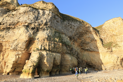
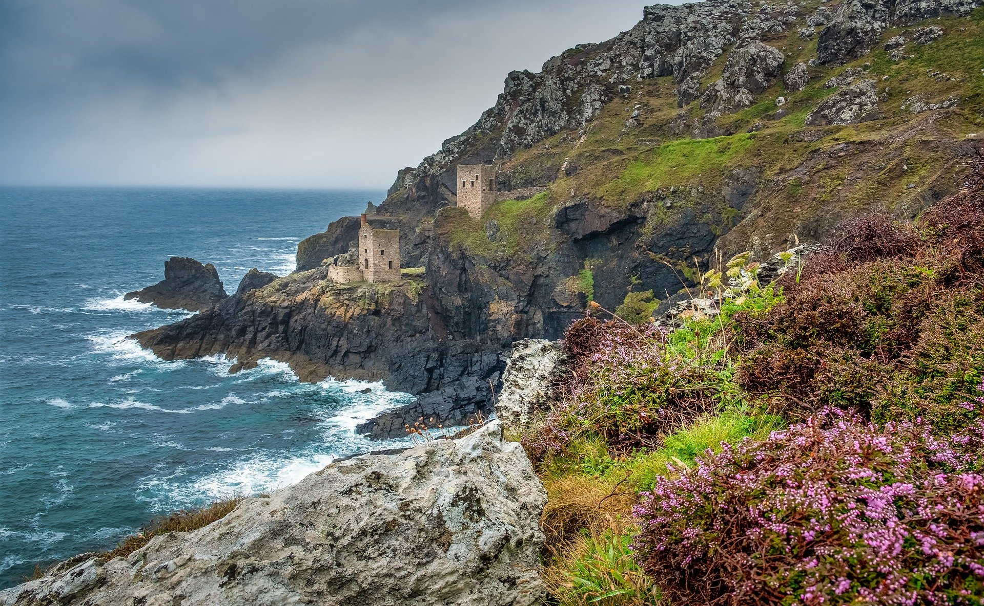
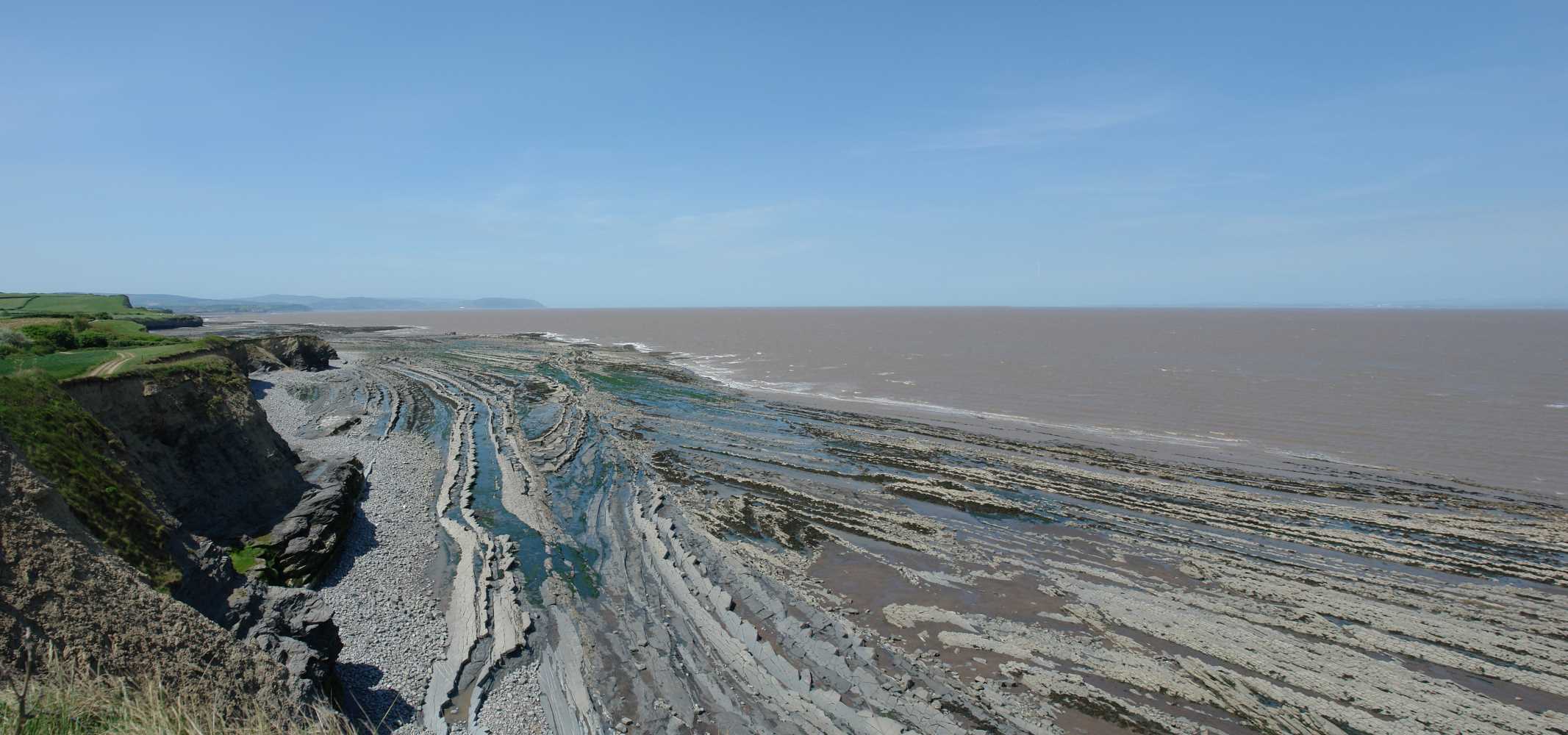
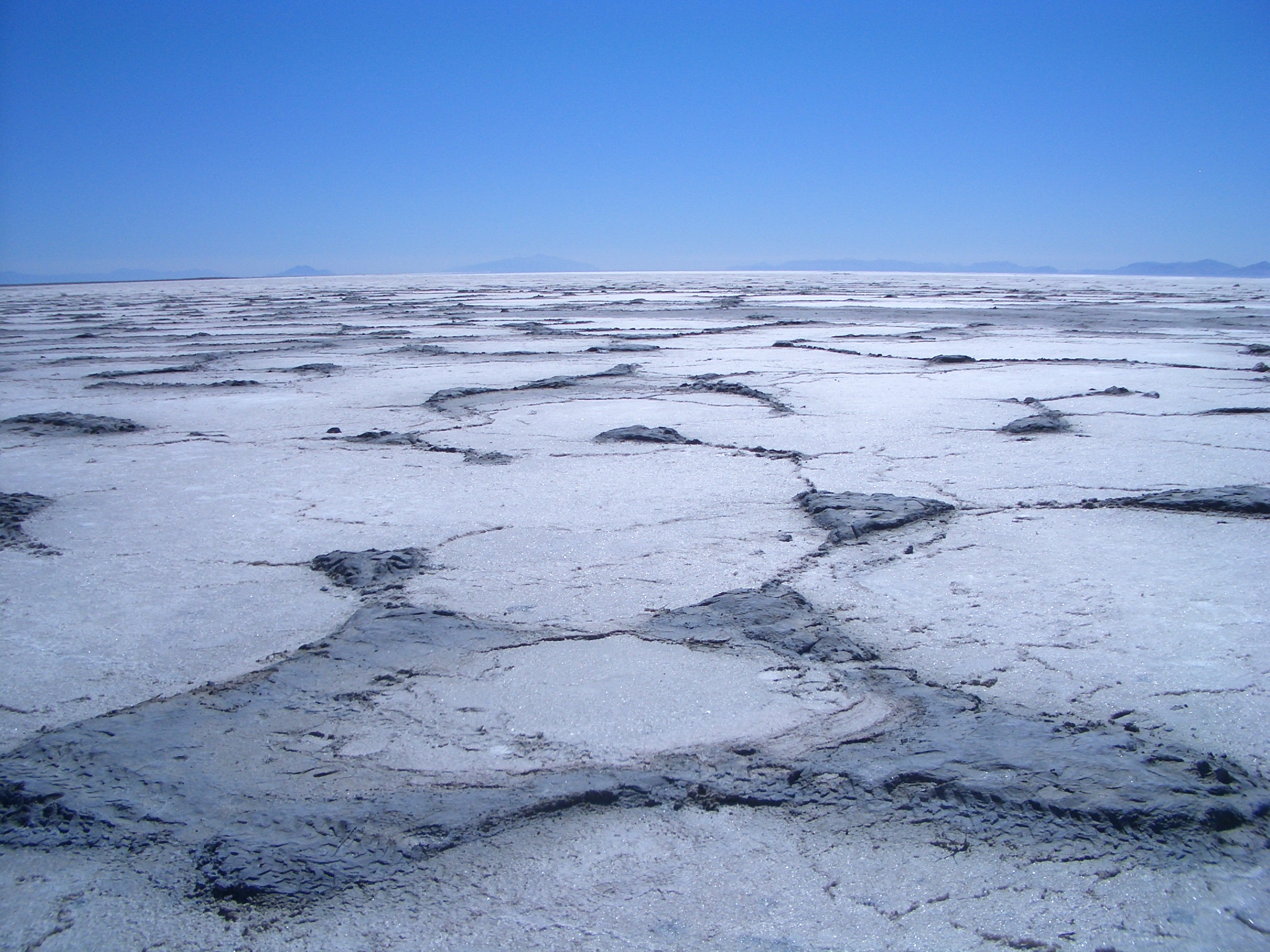
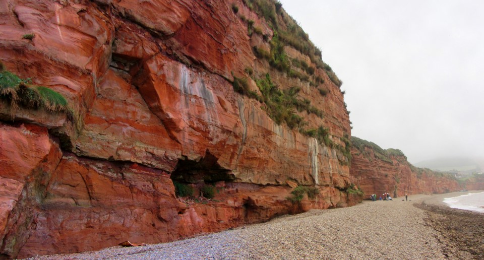
This course provides a field-based overview of reservoir characterization relevant to carbon capture and underground storage (CCS) and focuses on widely exploited reservoir depositional environments and their associated heterogeneity. The course links geological heterogeneity observed in well-exposed outcrop analogues with flow and transport processes during CO2 injection and plume migration, and also discusses the characterization and modelling of heterogeneity using typical subsurface datasets. The concepts are illustrated using numerous practical examples.

Duration and Logistics

A 5-day field course with a combination of field activities and exercises, plus classroom sessions. A manual and exercise materials will be distributed to participants on the course. Transport is by small coach.

Level and Audience

Intermediate. The course is intended for professionals with experience of, or background in, a related subsurface geoscience area, and / or recent graduates in a relevant topic.

Exertion Level

This class requires an EASY exertion level. Field locations are mainly accessed by hikes of 1–2km (roughly 1 mile) across some irregular terrain, including sandy beaches, coastal paths and pebbly / rocky beaches.

Objectives

You will learn to:

  1. Describe and explain types of geological heterogeneity associated with reservoirs, storage units and aquifers developed in common depositional environments.
  2. Evaluate how these heterogeneities can be characterized and quantified in the subsurface and represented in static and dynamic reservoir models.
  3. Consider the impact of these heterogeneities on fluid flow and transport in the context of CO2 storage.
  4. Understand reservoir characterization requirements for the prediction of CCS.

Plays, Prospects and Petroleum Systems, Wessex Basin, Dorset, UK (G054)

Tutor(s)

Jonathan Evans: Director, GeoLogica; Chair of Trustees, Lyme Regis Museum.

Overview

This course will illustrate the processes of play analysis and prospect evaluation using the geology of the Wessex Basin and outcrops of the Jurassic Coast of Devon and Dorset. The course will assess the elements of a working petroleum system including reservoir, source, seal and trap in the context of the Wytch Farm oilfield. Participants will have the opportunity to study a wide range of clastic and carbonate depositional systems, in addition to varying structural concepts, and visit two producing oil fields.

The manual will be provided in digital format and you will be required to bring a laptop or tablet computer to the course.

Duration and Logistics

A 5-day field course comprising fieldwork (70%) and classroom exercises (30%). The course will be based in Weymouth and transport will be by coach.

Exertion Level

This class requires an EASY exertion level. Outcrop access is easy with short walks of 1-2 km mostly across sandy beaches. Some field stops have more irregular terrain, in the form of pebbly and rocky beaches.

Level and Audience

Fundamental. The course is intended for junior-mid level geoscientists who are working in exploration as well as development and want a broad overview of key petroleum systems concepts or the chance to revise the key themes. The course would also be of value to reservoir engineers wanting to appreciate the role of, and subsurface data analysed by, the geological team.

Objectives

You will learn to:

  1. Understand the elements required in a working petroleum system and the concept of play analysis.
  2. Create play fairways maps based on fieldwork and published data.
  3. Examine the process of prospect evaluation and volumetric assessment including probability of success.
  4. Rank prospects based on the different play elements.
  5. Perform simple resource assessment and exploration risk analysis.
  6. Identify source rocks, how they form and what makes a good source rock.
  7. Compare different reservoir rocks, including sandstones and chalk, to work out how they were deposited and what controls the key reservoir properties of porosity and permeability at different scales.
  8. Describe different seals and flow barriers both above and within the reservoir intervals.
  9. Work with different types of subsurface data, as part of a team, and measure what scale of information they provide e.g. seismic, well logs, core, well tests, production tests.
  10. Analyse a series of local prospects and establish the geological chance of success.
  11. Assess the stages of a subsurface project from exploration through to development and production.
  12. Appreciate the different drilling and production technology in relation to the different reservoir types and project requirements.

Carbon Capture – Reservoir Storage and Risk Elements: Insights from the Field, NE England, UK (G550)

Tutor(s)

Richard Jones: Managing Director, Geospatial Research Ltd.

Overview

This course is framed around demonstrating the principles of CO2 storage capacity and risk elements of a prospective CCS play. Starting from basic geoscience principles, the course focuses on reservoir capacity estimation, injectivity and containment risks. The principles will be illustrated using well-exposed outcrop examples from NE England including clastic reservoirs from a variety of depositional settings (typically Carboniferous, Permo-Triassic, or Jurassic), sealing lithologies (mudrocks and evaporites) and structural controls on reservoir connectivity and containment (fractures, juxtaposition and fault zone complexity).

Duration and Logistics

A 5-day field course with fieldwork and practical sessions supported by classroom lectures. The course will be based in the historic city of Durham in NE England with easy access to coastal and inland locations in the counties of Durham, Northumberland and Yorkshire.

Level and Audience

Fundamental: The course is intended for subsurface scientists, including geologists and engineers, with a knowledge of petroleum geoscience, who are working on or new to, CCS projects.

Exertion Level

The course requires an EASY exertion level. Outcrops include coastal outcrop sections and inland exposures all with easy access. There will be some walks along beaches and easy paths to get to the outcrops with a maximum distance of around 5km (3 miles) or less, elevations vary from sea level to up to 500m (1600 ft). Temperature variations in late spring and summer are typically between 10 and 25°C (50–80°F).

Objectives

You will learn to:

  1. Characterize a variety of reservoir types (considering potential impacts of stratigraphic, depositional and structural heterogeneities, porosity and permeability) with respect to their suitability for carbon capture and storage.
  2. Estimate reservoir capacity through stratigraphic and structural analysis, and porosity estimation.
  3. Understand fluid transport parameters – injection/flow rate and reservoir permeability.
  4. Assess containment potential for CO2 (evaporitic and shale seals, faults and fractures).
  5. Evaluate fracture networks with respect to storage capacity, injection rates and containment risk.

Integrating Teams on the Rocks of the Wessex Basin, Dorset, UK (G056)

Tutor(s)

Jonathan Evans: Director, GeoLogica; Chair of Trustees, Lyme Regis Museum.

Overview

Proper integration of teams and disciplines is increasingly important in the modern energy industry. Ensuring all staff, technical, managerial and non-technical, understand the roles, concepts and language used by various disciplines as well as their requirements for data is critical for cooperation, collaboration and business success. This short course uses field observations and discussion at outcrops within the Wessex Basin to facilitate a deeper understanding of others’ roles as well as providing a refresher/reminder of the fundamental importance of rocks and the data they can provide to energy provision. The Wessex Basin provides a classic example of a working petroleum system with easily accessible outcrops to illustrate source rocks, reservoirs and trapping structures. In addition, the area also provides insights into new energy and carbon reduction methods that rely on a solid understanding of the subsurface.

Duration and Logistics

A 2-day field course in Dorset. For in-house provision the course can be extended or shortened depending on a company’s requirements.

Exertion Level

This class requires an EASY exertion level. Hikes are generally 1-2 km in length, on sandy and rocky beaches, coastal paths and with some irregular terrain.

Level and Audience

Fundamental. The level of the trip however, can be tailored to cater for the target audience: subsurface teams, integrated project teams or raising awareness for a generalist audience.

Objectives

Your team will learn to:

  1. Appreciate what elements are required for a working Petroleum System.
  2. Identify source rocks, how they form and what makes a good source rock.
  3. Compare different reservoir rocks, including sandstones and chalk, to work out how they were deposited and what controls the key reservoir properties of porosity and permeability at different scales.
  4. Understand what different types of subsurface data measure and what scale of information they provide e.g. seismic, well logs, core, well tests, production tests.
  5. Describe different seals both above and within the reservoir intervals.
  6. Understand the Petroleum Geology of the Wessex Basin including the giant Wytch Farm oilfield.

An Introduction to GeoEnergy Transition Projects: Field Seminar in Cornwall, UK (G518)

Tutor(s)

Alistair Donohew: Director, Kovia Consulting Ltd.

Richard Swarbrick: Manager, Swarbrick GeoPressure.

Overview

Cornwall is exceptionally rich in geological resource and is emerging as an important location for developing new technologies in the UK transition to a Net Zero economy. This course provides a snapshot of several operational and demonstration GeoEnergy Transition projects, as well as visits to associated traditional Cornish outcrops and rejuvenated mining operations. Examples of specific projects to be investigated include a deep geothermal energy site and a critical mineral (lithium) extraction site. Participants will also investigate sites previously considered for deep storage of nuclear waste and locations associated with low enthalpy energy from mine waters. Participants will gain a practical and technical understanding of several geoenergy projects and should be able to apply this learning to other geological locations worldwide.

Duration and Logistics

A 6-day field course with a combination of field activities and exercises, plus classroom sessions.

Level and Audience

Fundamental. This course is intended for technical professionals working in related sectors. Participants will be shown the context and challenges for developing low carbon technologies for energy, as well as the parallel examination of surface renewable energy technologies.

Exertion Level

This class requires an EASY exertion level. Field locations are mainly accessed by a short walk of less than 1 mile (1.6km) along coastal paths or on sandy / cobbled beaches. Other field stops include working industrial sites (e.g. quarries).

Objectives

You will learn to:

  1. Describe and explain the geoenergy resource potential of Cornwall.
  2. Characterize ideal locations and explain technical factors that affect different resource potentials.
  3. Describe how wider factors can affect feasibility of certain geoenergy resources, including the environmental, social and economic (political and commercial) factors.
  4. Evaluate strategic choices for local and regional policy makers, as well as landowners and investors.

Natural Fractures (Faults and Joints): Quantification and Analysis, Somerset, UK (G033)

Tutor(s)

Mark Bentley: TRACS International Consultancy and Langdale Geoscience.

Overview

This course will explore superb exposures of fault and joint systems within the Triassic/Lower Jurassic of the East Bristol Channel and Central Somerset Basins, focusing on 3-D seismic scale fault systems, including a variety of fracture geometries, fabrics and networks. Field analysis will be supported by materials on stress, strain and fracture development, as well as an analysis of both seal potential and flow potential. Key challenges regarding predicting fracture volumetrics and the challenges of fault seal will be addressed, including how to bridge the gap between outcrop detail and seismic structures and how to represent fractures in reservoir models, whether they be sealing or conductive to flow.

Duration and Logistics

5 days; a mix of field visits (50%) and classroom lectures with exercises (50%).

Exertion Level

This class requires an EASY exertion level. Somerset is quite comfortable in the spring and early summer, with temperatures of 5–20°C (40–65°F) and occasional rain showers. Field stops require short walks along coastal paths, beaches and wave cut platforms. The longest walk is <4km (2.5 miles). Field stops are all at approximately sea level and some are tide dependent. Transport will be by coach.

Level and Audience

Fundamental. The course is designed for geoscientists, petrophysicists, reservoir engineers and well engineers. Ideally structured for groups working in multi-discipline, asset-based teams with structurally complex reservoirs wishing to understand fracture properties and their impact on fluid flow.

Objectives

You will learn to:

  1. Characterize fracture systems and geometries in the subsurface.
  2. Quantify fault properties, including sealing capacity and threshold pressure.
  3. Quantify open natural fracture properties.
  4. Address modeling challenges for fracture type and fracture property distribution.
  5. Represent fractures (both faults and joints) in reservoir simulations.
  6. Evaluate risk and uncertainty associated with fracture modeling.
  7. Evaluate the impact of fractures on well planning and seal integrity.

Sand-rich Turbidite Systems: From Slope to Basin Plain, Pyrenees, Spain (G016)

Tutor(s)

Henry Pettingill: Senior Associate, Rose & Associates LLP; President, Geo Ventures International Inc.

Overview

This course in the Central Pyrenees will visit spectacular outcrops of Eocene deep marine clastics in the confined mini-basin settings of the Ainsa and Jaca basins. Shelf-slope-basin relations are examined in detail and reveal features such as ponding in sub-basins, system architecture and reservoir stacking patterns. Identification of facies types is emphasized at both reservoir and exploration prospect scales. The use of the outcrops as analogs for producing oil and gas fields is discussed and 3-D models of the basin infill and deep marine deposition will be shown. Attendees are encouraged to bring their own data for discussion as either presentations or as posters.

Duration and Logistics

A 6-day field course comprising a mix of outcrop examination and discussion (70%), core examination (15%) and supporting classroom lectures (15%). The course is conducted in the Central Pyrenees of northern Spain, with attendees arriving in and departing from Barcelona, Spain. The course materials are supplied as a short, printed field guide with supporting lecture material provided in digital format – if you wish to access this while on the course you will need to bring a laptop or tablet computer.

Level and Audience

Advanced. Suitable for geoscientists and reservoir engineers seeking to understand deepwater clastic reservoir distribution, prediction and compartmentalization. Appropriate for asset teams looking to develop a common understanding of their deepwater clastic reservoirs.

Exertion Level

This class requires an EASY exertion level. Travel between outcrops will be by small coach and there are several short hikes of 2–3km (1.2–1.8 miles) over uneven ground, but nothing overly strenuous. The weather can be variable and ranges from hot and dry to cold and very wet, with fall temperature ranges of 5–30°C (40–85°F), so please be prepared. Field days start around 9am and finish at 6–7pm. (Please note that meals are taken rather late by North American and northern European standards.)

Objectives

You will learn to:

  1. Recognize genetically linked facies deposited by submarine gravity flow processes within a partitioned foredeep, from slope to basin plain.
  2. Identify the transitions between the various components of the system (channel, lobe, etc.), their controls and predictive aspects.
  3. Characterize the geometry and scale of sand bodies and their stacking patterns in outcrop and compare with reservoir units in analogous subsurface settings.
  4. Assess the relation between syndepositional tectonics and partitioned mini-basins that act as receiving basins.
  5. Assess and predict the control of sand body geometry and reservoir architecture on reservoir production characteristics.
  6. Assess high-frequency cyclicity recorded in the sediments and relate these patterns to intrinsic and extrinsic basin controls.
  7. Apply predictive models for the infill of facies and stacking patterns based on the interplay between mini-basin geometry/development and sediment infill.

Modern and Ancient Carbonate Lakes of the Western U.S.: Lessons for Interpreting the Cretaceous Pre-Salt Reservoirs in the South Atlantic, Utah, Nevada and California (G030)

Tutor(s)

Paul Wright: Independent Consultant.

Overview

The pre-salt “microbialite” reservoirs of offshore Brazil and West Africa (such as the Barra Velha Fm of Santos Basin) are highly problematic reservoirs. While there are no modern or ancient analogs for the Barra Velha and its equivalents, the modern rift basin lakes in western U.S. can be used to demonstrate a range of issues relevant to understanding the reservoirs. This course combines field visits with classroom lectures and core examination, and throughout the course comparisons will be made with the pre-salt reservoirs from the South Atlantic to provide a forum for discussion to aid understanding of these reservoirs.

The manual will be provided in digital format and you will be required to bring a laptop or tablet computer to the course.

Duration and Logistics

6 days; a mix of field stops (70%), classroom lectures (15%) and core examination (15%).

The course begins in Salt Lake City, Utah, and ends in Reno, Nevada.

Exertion Level

This class requires an EASY exertion level. The longest walk on the class is approximately 3.2km (2 miles) over fairly flat topography. Outcrops are at elevations of 1200–2000m (4000–6500 ft). Weather conditions in northern Utah and eastern California can vary from cool and dry, to hot and dry, with a late spring and early fall temperature range of 5–27°C (40–80°F). Transport will be in a bus or SUVs on black-top roads.

Level and Audience

Advanced. The course will be of particular interest to individuals evaluating the pre-salt of Brazil and West Africa but will also appeal to geoscientists who wish to expand their knowledge of non-marine reservoirs. A basic familiarity with carbonates depositional systems is assumed.

Objectives

You will learn to:

  1. Examine a range of classical carbonate facies in core, including core from an active microbialite reservoir in the US.
  2. Examine the scale relationship of carbonate deposition in the field across a series of half grabens using the Great Salt Lake, Utah, as an example.
  3. Examine an active petroleum system associated with volcanic-related rift activity and lacustrine carbonates.
  4. Examine many of the key elements of the carbonate facies encountered in arid saline lakes (microbialites, oolites, salt pans, travertines and large spit complexes) including the subtle influence of small faults on facies distribution.
  5. Examine seismic-scale carbonate build-ups associated with faults in an alkaline lake (Pyramid Lake, Nevada), including how sub-lacustrine fault-controlled fluid flows generate large build-ups and the effects of subaerial exposure on such build-ups.
  6. Examine the complex facies architecture of vent-fed sub-lacustrine carbonate systems.
  7. Examine the range of facies associated with vent-fed ridge travertines and evaluate whether such systems can be used as analogs for some pre-salt reservoirs, using outcrops near Bridgeport, California.
  8. Examine carbonate deposition in a highly alkaline lake, Mono Lake in California, very closely associated with volcanic cones, emphasizing the role of volcanic activity in rift basins.