World-class training for the modern energy industry

Building a Reservoir Model, Pembrokeshire, UK (G055)

Tutor(s)

Mark Bentley: TRACS International Consultancy and Langdale Geoscience.

Overview

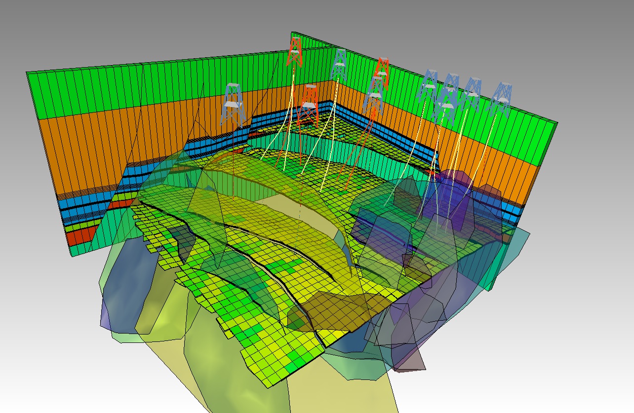
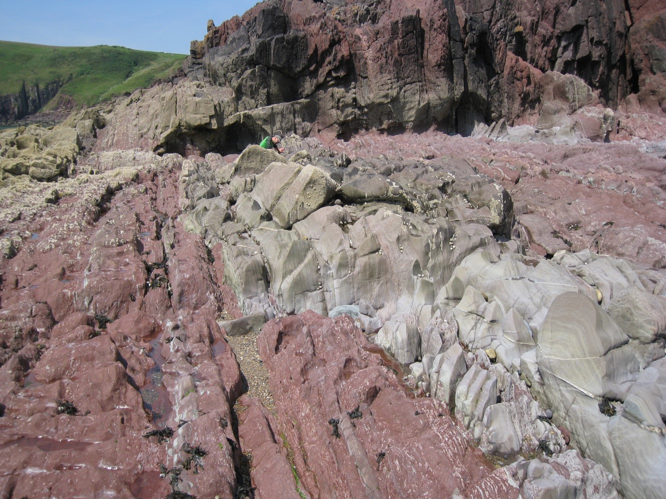
This course offers a software-independent view on the process of reservoir model design and simulation model-building, addresses the underlying reasons why some models disappoint and offers solutions that support the building of more efficient, fit-for-purpose models. The thread through the week is a model design for the notional ‘Pembroke Field’ – a synthetic field constructed from reservoir analogue outcrops in South Pembrokeshire.  The Pembroke Field contains three contrasting reservoir types: continental clastics, shallow marine deltaics and naturally fractured carbonates, in both structurally deformed and undeformed settings. Data from producing oil and gas fields has been scaled to the synthetic models to create a realistic hydrocarbon field accumulation, ready for development.

Objectives

You will learn to:

  1. Create a fluid-sensitive conceptual model for a heterogeneous reservoir, built from a selection of elements and placed in a realistic architectural framework: the “sketch”.
  2. Guide the use of geostatistical tools intuitively, balancing deterministic and probabilistic components with awareness of the limits of the tools.
  3. Select appropriate methods for modeling of matrix properties, including the handling of net (cut-off’s vs total property modeling).
  4. Evaluate options for multi-scale modelling and the possible need for multi-scale approaches based on hierarchical understanding of Representative Elementary Volumes (REV).
  5. Understand issues surrounding permeability modeling and why this differs from the handling of other properties.
  6. Learn a rule of thumb (“Flora’s rule”) to help assess what level of static model detail matters to flow modeling and forecasting.
  7. Review how to use well test analysis to constrain models.
  8. Review options for model-based uncertainty handling (base case led, multi-deterministic scenarios, multi-stochastic ensembles), learn how to post-process the results and how to select an appropriate workflow which minimizes impact of behavioral bias.

Exertion Level

This class requires an EASY exertion level. Field stops require short walks along coastal paths, beaches and wave cut platforms. The longest walk is <5km (3 miles). Field stops are all at approximately sea level and some are tide dependent. Transport will be by coach.This class requires an EASY exertion level. Field stops require short walks along coastal paths, beaches and wave cut platforms. The longest walk is <5km (3 miles). Field stops are all at approximately sea level and some are tide dependent. Transport will be by coach.

Level and Audience

Intermediate. The course is aimed at geoscientists with knowledge of reservoir modeling software, petrophysicists who provide input to static reservoir models and reservoir engineers involved in simulation work who deal with the static-dynamic interface on a regular basis. The course is also of benefit to team leaders who wish to have a deeper understanding of the principles behind modeling and how to QC models made by others.

Duration and Logistics

7 days; a mix of field work (70%), and classroom exercises (30%).
Workshop on the Seismic Expression of Carbonates (G080)

Tutor(s)

Gene Rankey: Professor, University of Kansas.

Overview

The aim of this course is to provide a general overview of the basic principles of carbonate systems and their expression in seismic data, and to demonstrate its utility for exploration and production. The course will include conceptual models, practical hands-on exercises, and demonstrations of the utility of seismic data and derived products. Key examples will illustrate how seismic stratigraphy and seismic attribute analysis can be used to assess reservoir fairways, subdivide a reservoir, constrain reservoir models, and generate high-resolution, geologically constrained predictions of reservoir systems. An important part of this course will be to draw attention to unique aspects of carbonates and how they might differ from siliciclastic from pore to basin scales.

Objectives

You will learn to:

  1. Establish a working knowledge of carbonate sediment and depositional systems.
  2. Assess carbonate seismic attributes, their general classes, and situations in which different types of attributes are most appropriate.
  3. Evaluate quantitative applications of seismic attributes to map seismic facies and porosity in carbonate reservoirs.
  4. Recognize the expression of carbonates in three-dimensions, how these patterns reflect dynamic stratigraphic evolution, and how these patterns can be related to reservoir trends.
  5. Identify the variation and controls on carbonate reservoir architecture in different system tracts.
  6. Appreciate how carbonate petrophysics influences the seismic response of carbonates.
  7. Appraise the different types of carbonate platform on seismic data and assess the presence of key seismic facies.
  8. Illustrate the seismic geometries of carbonate ramps and rimmed shelves and their possible reservoir character.

Level and Audience

Intermediate. The course is aimed at geologists and geophysicists working on carbonate exploration and production projects. No prior knowledge of carbonates is assumed but participants should have some background in the geosciences.

Duration and Logistics

Classroom version: 2 day classroom course comprising presentations, exercises and case studies. Course notes and exercise materials will be distributed to participants during the course. The manual will be provided in digital format and participants will be required to bring a laptop or tablet computer to follow the lectures and exercises

Virtual version: Four 3.5-hour interactive online sessions presented over four days. Digital course notes and exercise materials will be distributed to participants before the course. Some exercises may be completed by participants off-line.

Characterization of Clastic Reservoirs: Workflows for Reservoir Evaluation (G035)

Tutor(s)

Rene Jonk: Director, ACT-Geo Consulting and Training; Honorary Professor, University of Aberdeen.

Overview

Reservoir mapping at production scale has to be performed with an understanding of clastic depositional systems, with full integration of core, core-plugs, well logs, seismic and production and engineering data. The variation in reservoir architecture of most common deposition-system morphotypes strongly influences development and production strategies, as well as in mapping techniques for not only the field scale but also to increase chances of finding near-field opportunities. The workshop examines common reservoir facies in transitional-marine to deep water systems, from fluvio-, wave- and tidal-dominated deltas, incised valleys, deep water channel systems and distributary channel lobe systems (deep water fans). Discussions include dimensional data of sand bodies in the different environments and recognition criteria in cores, well logs and seismic. The class will present optimized workflows for reservoir mapping, including the definition of the deliverables that need to be achieved in different business stages, focusing on when, why and how to develop them.

Duration and Logistics

Classroom version: 3 days; a mix of lectures (55%), core observation (10%) and hands-on exercises (35%). The manual will be provided in digital format and participants will be required to bring a laptop or tablet computer to follow the lectures and exercises.

Virtual version: Five 4-hour interactive online sessions presented over 5 days. A printed manual and exercise materials will be distributed to participants before the course and several exercises are to be completed by participants off-line.

Level and Audience

Advanced. This course is intended for geologists, geophysicists and petrophysicists with basic training in sequence stratigraphy and basic clastic facies.

Objectives

You will learn to:

  1. Recognize different environments of deposition (EoDs) in cores, emphasizing typical facies stacking in common transitional marine and deep marine reservoirs.
  2. Classify facies and stacking in typical transitional marine to deep marine EoDs.
  3. Mechanisms for sediment transport in different EoDs and impact on reservoir rock properties.
  4. Integrate core and core plug information in reservoir analysis, tying to well log and seismic data.
  5. Recognize typical log patterns in different depositional systems.
  6. Recognize typical seismic map views and cross-sectional views of sand-rich EoDs.
  7. Apply mapping techniques for well logs and seismic with emphasis on identification of EoDs.
  8. Make pre-drill predictions based on understanding of EoDs and seismic response.
  9. Understand dimensional data for sandbodies in different EoDs
  10. Implement reservoir mapping workflows that emphasize data integration and focus on deliverables in different business stages.

How to Make a Good Reservoir Model: It’s Not the Software, It’s the Design (G036)

Tutor(s)

Mark Bentley: TRACS International Consultancy and Langdale Geoscience.

Overview

How can you tell the difference between a ‘good’ reservoir model and a ‘bad’ one? This short, focused class is designed to draw out the common reasons for ‘good’ and ‘bad’ outcomes, under the premise that models add value only when they add clear value to business decisions. The theme throughout the event will be the overriding issue of model design and the five areas of common error: model purpose; selection of elements; use of determinism and probability; model scale; and uncertainty handling. Advice will be given on how to review models, what questions to ask the model builders, and how to determine whether the output from models can be relied upon and used to support decisions. The course will close with a set of questions to ask yourself and others, suitable for reference in peer reviews or assists.

Duration and Logistics

Classroom version: A 1-day course comprising a mix of lectures, case studies and exercises. The manual will be provided in digital format and participants will be required to bring a laptop or tablet computer to follow the lectures and exercises.

Virtual version: Two 4-hour interactive online sessions presented over 2 days. A digital manual and exercise materials will be distributed to participants before the course. Some reading and several exercises are to be completed by participants off-line.

Level and Audience

Fundamental. Designed for people who want an update or refresh on working with reservoir models without having to spend a week out of the office. The class will provide an opportunity for learning, inspiration and discussion with other modelers.

Objectives

You will learn to:

  1. Explain the common causative factors for modelling ‘disappointments’.
  2. Define model purpose and explain the use of framing.
  3. Understand the fluid sensitivity to selection of model elements.
  4. Describe techniques for handling small-scale detail in large models.
  5. Be able to select between techniques for quantifying uncertainty.
  6. Implement QC tips to evaluate your (and other people’s) models.

Seismic Processing Workflows (G072)

Tutor(s)

Rob Hardy: Director, Tonnta Energy Limited.

Overview

This course will provide participants with the skills needed to liaise with specialists and implement workflows for seismic data acquisition and processing. Using modern case histories and basic theory, the course covers fundamentals, established workflows and advanced technology. Participants will use interactive processing tools to improve their understanding of the latest techniques and learn how to apply them effectively and efficiently to meet their objectives.

Duration and Logistics

Classroom version: A 3-day in-person course, comprising a mix of lectures with examples (90%), laptop-based exercises and discussion (10%). The manual will be provided in digital format and participants will be required to bring a laptop or tablet computer to follow the lectures and exercises.

Virtual version: Six 3-hour interactive online sessions presented over 6 days, comprising a mix of lectures, discussion and interactive exercises using case histories to illustrate the basic theory and impact of the techniques discussed. The participants will use a series of web-based software modules to experience the processing options available and learn how to combine the basic tools together to build a flow which meets objectives. A digital manual and exercise materials will be distributed to participants before the course. Some reading and several exercises are to be completed by participants off-line.

Level and Audience

Intermediate. This course is aimed at geoscientists seeking an overview of seismic acquisition techniques and processing methods, and those who wish to liaise effectively with specialists to improve their decision making and deliver objectives. A geophysics refresher is provided but it is helpful if participants have a basic knowledge of seismic acquisition and processing terminology and are actively working with seismic data.

Objectives

You will learn to:

  1. Compare the most common seismic acquisition and processing techniques used in seismic exploration and production, and become more proficient in the terminology used to describe them.
  2. Establish how survey design, earth model building and selection of migration algorithm can affect accuracy of interpretation in depth.
  3. Optimize the impact of seismic processing parameter selection for specific objectives such as amplitude interpretation for exploration and reservoir characterization.
  4. Demonstrate a typical seismic processing workflow covering data preparation, parameterization, noise and multiple suppression, velocity model building, and the imaging process, discussing likely issues at each step.
  5. Compare newer acquisition and processing techniques alongside their potential benefits and pitfalls.
  6. Liaise effectively with specialists, develop workflows and optimize decisions based on quality and cost.

Modern and Ancient Tide- and Wave-influenced Depositional Systems: Subsurface Uncertainties in Shallow Marine Reservoirs, SE England, UK (G070)

Tutor(s)

Howard Johnson: Shell Professor of Petroleum Geology, Head of the Petroleum Geoscience and Engineering Section, and Director of Petroleum Geoscience, Imperial College London.

Overview

Tide- and wave-influenced marginal marine hydrocarbon reservoirs offer a range of subsurface interpretation and development challenges. This course will use both modern and ancient systems to analyze the architecture, internal characteristics, distribution and reservoir quality of a variety of sand-dominated deposits. Modern deposits of the North Norfolk coastline will be used to explore the range of depositional processes operating and the resultant spatial distribution and internal attributes of potential reservoir units. These will be compared with Lower Cretaceous outcrops preserving a range of tidal-influenced and marine embayment deposits. Focus will be placed on the key development challenges in these marginal marine clastic systems.

Duration and Logistics

A 5-day field course comprising a mix of fieldwork, classroom lectures and practical sessions. Classroom learning and field observations will be supported and reinforced by exercise work. The course will be based in Hunstanton with easy access to the coastal field area. Transport will be by coach.

Level and Audience

Intermediate. The course is intended for geologists and reservoir engineers with a knowledge of petroleum geoscience who are working on marginal marine reservoir systems, particularly those preserving evidence of tidal influence.

Exertion Level

This field course requires an EASY exertion level. The first field day is in a quarry at Leighton Buzzard and involves a walk of about 2km (1.25 miles) to the main quarry face. The remaining field locations on the Norfolk coast are accessed by walks of less than 3.5km (2 miles) along flat sandy beaches and tidal channels that may be muddy and slippery in parts.

Objectives

You will learn to:

  1. Interpret the depositional processes and environments that occur in fluvial-, tide- and wave-influenced clastic coastal depositional systems and relate these to the recognition of their ancient equivalents.
  2. Relate individual modern environmental systems to the larger regional-scale, including modern and ancient marine embayment and coastal barrier systems.
  3. Consider the range of geological controls on the reservoir architecture of clastic coastal deposits and relate this understanding to prediction of reservoir sand presence, geometry and rock properties.
  4. Analyze shallow marine sands in outcrop, with particular focus on internal heterogeneity, including potential permeability barriers and baffles.
  5. Assess the broader scale outcrop setting, in terms of the basinal depositional framework and use this understanding to inform prediction of reservoir distribution.
  6. Place clastic coastal depositional systems into their sequence stratigraphic significance, including addressing reservoir occurrence in transgressive and regressive settings.
  7. Use the modern and ancient examples discussed in the classroom and observed in the field to consider implications for exploration and development, particularly with regards to the subsurface reservoirs of the North Sea.

Progressive Deformation in the Arbuckle and Wichita Mountains: Implications for Mid-Continent and Resource Plays, Oklahoma (G083)

Tutor(s)

Kevin Smart: Manager, Earth Science Section, Space Science and Engineering Division, Southwest Research Institute.

David Ferrill: Institute Scientist, Space Science and Engineering Division, Southwest Research Institute.

Overview

This field seminar will explore natural deformation in Paleozoic rocks in and around the Wichita and Arbuckle uplifts in southern Oklahoma. Investigating mechanical stratigraphy and the regional tectonic setting provides the context for understanding deformation features, such as joints, shear fractures, folds, faults and stylolites. Outcrop observations will be tied to the deformation conditions under which they developed, and related to the subsurface (cores, logs and stress data), to illustrate the critical importance of understanding deformation in the subsurface, including both pre-existing natural deformation and as analogs for deformation produced by induced hydraulic fracturing.

Duration and Logistics

A 5-day field course, comprising a mix of field exercises (85%) and classroom work (15%). The course will start in Lawton, Oklahoma, and end near Ardmore, Oklahoma.

Level and Audience

Intermediate. The course is aimed at geoscientists, petrophysicists, reservoir engineers and production engineers working in mechanically layered, deformed rocks in Oklahoma or other relatively gently deformed sedimentary foreland basins. It will be of particular interest to any geoscientists, petrophysicists and engineers working in unconventional reservoirs, including those in the Anadarko Basin.

Exertion Level

This course requires an EASY exertion level. Fieldwork is in southern Oklahoma, where the climate can be variable according to the season. Transportation is by SUVs. Most driving is on black-top roads, and most outcrops are adjacent to roads or within inactive quarries with uneven ground, where long strenuous hikes are not needed to access the exposures.

Objectives

You will learn to:

  1. Identify small-scale deformation features that are common in the SCOOP/STACK plays of the Anadarko basin and other unconventional reservoirs.
  2. Interpret stress conditions and stress evolution from small-scale deformation features.
  3. Characterize mechanical stratigraphy based on lithostratigraphy and rock strength information.
  4. Relate deformation styles to the tectonic setting of southern Oklahoma.
  5. Assess the role of mechanical stratigraphy, stress conditions and pre-existing deformation features on rock behavior, including fracture prediction in unconventional and conventional reservoirs.
  6. Consider, in general terms, the behavior of lithological units under different well completion strategies.
  7. Evaluate geomechanical issues for common petroleum and unconventional resource applications such as well design, borehole stability and hydraulic fracturing.

Salt Tectonics of the Gulf of Mexico (G092)

Tutor(s)

Mark Rowan: President, Rowan Consulting, Inc.

Overview

The objective of this 3-day course is to provide geoscientists with a detailed explanation of those aspects of salt tectonics applicable to the northern and southern Gulf of Mexico (GoM) salt basins. It consists primarily of lectures, with examples from the GoM and other basins, that are supplemented by practical exercises. The emphasis is on fundamental mechanics and processes, structural geometries and evolution, salt-sediment interaction and the implications for hydrocarbon exploration and production.

Duration and Logistics

A 3-day in-person classroom course, comprising a mix of lectures (75%) and seismic exercises (25%). The manual will be provided in digital format and participants will be required to bring a laptop or tablet computer to follow the lectures and exercises.

Level and Audience

Intermediate. The course is intended for geoscientists working the Gulf of Mexico and is also applicable to salt basins around the world.

Objectives

You will learn to:

  1. Understand the implications of layered-evaporite sequences for velocity-model building and seismic interpretation.
  2. Describe how halite differs from other lithologies and how that impacts deformation in salt basins.
  3. Characterize the ways in which extension, contraction and differential loading trigger salt flow and diapir initiation / growth.
  4. Interpret typical salt and stratal geometries associated with salt evacuation and diapirism.
  5. Predict how drape folding around passive diapirs impacts stratal geometries, faulting and reservoir distribution in diapir-flank traps.
  6. Understand why and how allochthonous salt forms and how salt sheets / canopies evolve.
  7. Assess the effects of salt on various aspects of the petroleum system, including trap formation, reservoir presence, hydrocarbon maturation and migration and seal.

Trap and Seal Analysis: Theory and Application (G090)

Tutor(s)

Russell Davies: Director, Redlands Fault Geological Consulting LLC.

Overview

This course introduces the concepts and methods in trap and seal analysis, particularly in relation to fault characterization, including fault mapping and fault seal, as applied to cross-fault flow resistance in traps for hydrocarbons and carbon containment in subsurface reservoirs. The course additionally includes the analysis of caprock (top seal) for predicting seal capacity and evaluating risks associated with capillary and mechanical controls. Overall, the course emphasizes the importance of an integrated approach to trap and seal analysis in subsurface reservoirs. The lectures introduce fundamentals and advanced concepts for faulting and flow for the prediction of fault behavior in subsurface traps and the concepts discussed are applied in simple exercises to reinforce learning.

Duration and Logistics

Classroom version: A 4-day classroom course, comprising a mix of lectures (65%) and hands-on exercises (35%). The manual will be provided in digital format and participants will be required to bring a laptop or tablet computer to follow the lectures and exercises.

Virtual version: Five 4-hour interactive online sessions presented over five days. Digital course notes and exercise materials will be distributed to participants before the course. Some exercises may be completed by participants off-line.

Level and Audience

Intermediate. The course is intended for geoscientists (geologists and geophysicists) and petroleum engineers, so they can apply these principles in their subsurface projects.

Objectives

You will learn to:

  1. Analyze fault geometries and architecture, apply this knowledge to make robust fault interpretations.
  2. Assess fault rock types and properties and likely impacts on fluid flow across and along faults.
  3. Conduct juxtaposition seal analysis and employ triangle diagrams.
  4. Apply algorithms, such as SGR and CSF, for predicting clay contents across faults.
  5. Assess the relationship between threshold pressure and fault seal capacity against the clay content predicted across fault surfaces.
  6. Characterize faults as potential migration and leakage pathways.
  7. Evaluate the geomechanical and capillary properties of top seal units.

Engineering of Resource Plays for Technical Professionals (G003)

Tutor(s)

Yucel Akkutlu: Professor, Texas A&M University.

Overview

This course presents the terminology, methodology and concepts of drilling, completion and reservoir engineering as applied to unconventional resource plays, including oil-rich shales, gas shales and coal-seam gas. It will cover the latest practices as well as discuss future directions in unconventional resource engineering. Case studies are used to illustrate particular challenges presented by these plays. The environmental impacts on air and water resources are considered. Participants will learn to become more effective members of multi-disciplinary resource evaluation teams by developing a solid understanding of appropriate engineering concepts and terminology.

Duration and Logistics

Classroom version: A 3-day course comprising a mix of lectures (70%), case studies (20%) and exercises (10%). The manual will be provided in digital format and participants will be required to bring a laptop or tablet computer to follow the lectures and exercises.

Virtual version: Five 4-hour interactive online sessions presented over 5 days, including a mix of lectures (70%), case studies (20%) and exercises (10%). A digital manual and hard-copy exercise materials will be distributed to participants before the course.

Level and Audience

Intermediate. The course is designed for technical professionals and managers who want to understand the role of the engineer in resource play projects. In particular, geoscientists, petrophysicists and drilling, completion and stimulation engineers would benefit from the course.

Objectives

You will learn to:

  1. Discuss aspects of reservoir, drilling, completion and stimulation engineering with engineering members of unconventional project teams.
  2. Contrast engineering approaches to conventional and unconventional projects.
  3. Assess resource estimates, production forecasts and economic evaluations for unconventional plays.
  4. Review the sampling procedures adopted by reservoir engineers.
  5. Predict the hydrocarbon phase change in reservoirs.
  6. Assess the demand for and disposal of water associated with fracturing and producing unconventional reservoirs.
  7. Assess the impact of unconventional projects on air quality.
  8. Discuss recent advances in the optimization of resource plays.