Tutor(s)
Rene Jonk: Director, ACT-Geo Consulting and Training; Honorary Professor, University of Aberdeen.
Overview
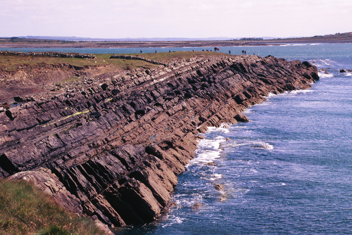
Given the high cost of exploration and development of deepwater reservoirs, it is essential to have an accurate pre-drill prediction of reservoir architecture and properties, and to integrate post-drill assessments of reservoir heterogeneity away from well penetrations. The outcrops of the Ross Formation offer a unique opportunity to observe seismic-scale exposures of a deepwater fan system with characteristics similar to the producing fields in West Africa, Brazil and the Gulf of Mexico, to name a few. The size and quality of the exposures allow the participants to observe the main building blocks of fan systems. Lobes and distributary channels can be observed from proximal to distal settings, with excellent exposures of vertical stacking and 2-D arrangements of these elements.
Duration and Logistics
A 7-day field course comprising a mix of field activities with exercises (60%) and classroom lectures with exercises (40%). Exercises emphasize practical applications and will focus on description of deepwater lithofacies, stratal geometries and recognizing key stratigraphic surfaces. The course is based in Kilkee Bay, Ireland, with participants flying in and out of Shannon, Ireland.
Level and Audience
Advanced. This course is intended for geoscientists, petrophysicists, engineers and managers who are seeking to gain a comprehensive understanding of deepwater reservoirs.
Exertion Level
This class requires an EASY exertion level. Access to the coastal outcrops is relatively easy and there will be walks of up to 2km (1.2 miles) most days, all at sea level. The longest walk on the class is approximately 3.2km (2 miles), with no ascent or descent over 50m (160 feet). Summer weather can be cool and wet, or warm and wet, with a daily temperature range of 4–24°C (40–74°F). Transport will be by van on paved roads.
Objectives
You will learn to:
- Interpret and map different archetypes of deepwater reservoirs using cores, well-logs and seismic lines, from exploration to production business scales.
- Define trap configurations and perform risk assessment for stratigraphic traps.
- Estimate reservoir presence risk and predict N:G.
- Interpret environments of deposition (EoDs) and related reservoir architecture, lithofacies associations and diversity.
- Evaluate reservoir geometry and connectivity in different EoDs, integrating with production data.
- Define depositional geometries of turbidites in seismic-scale outcrops.