World-class training for the modern energy industry

Fundamentals of Petroleum Systems: Source, Maturation and Migration (G120)

Tutor(s)

Rene Jonk: Director, ACT-Geo Consulting and Training; Honorary Professor, University of Aberdeen 


Overview

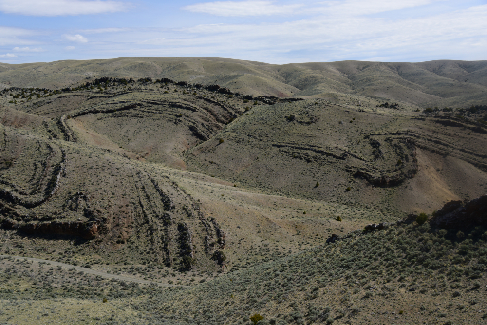
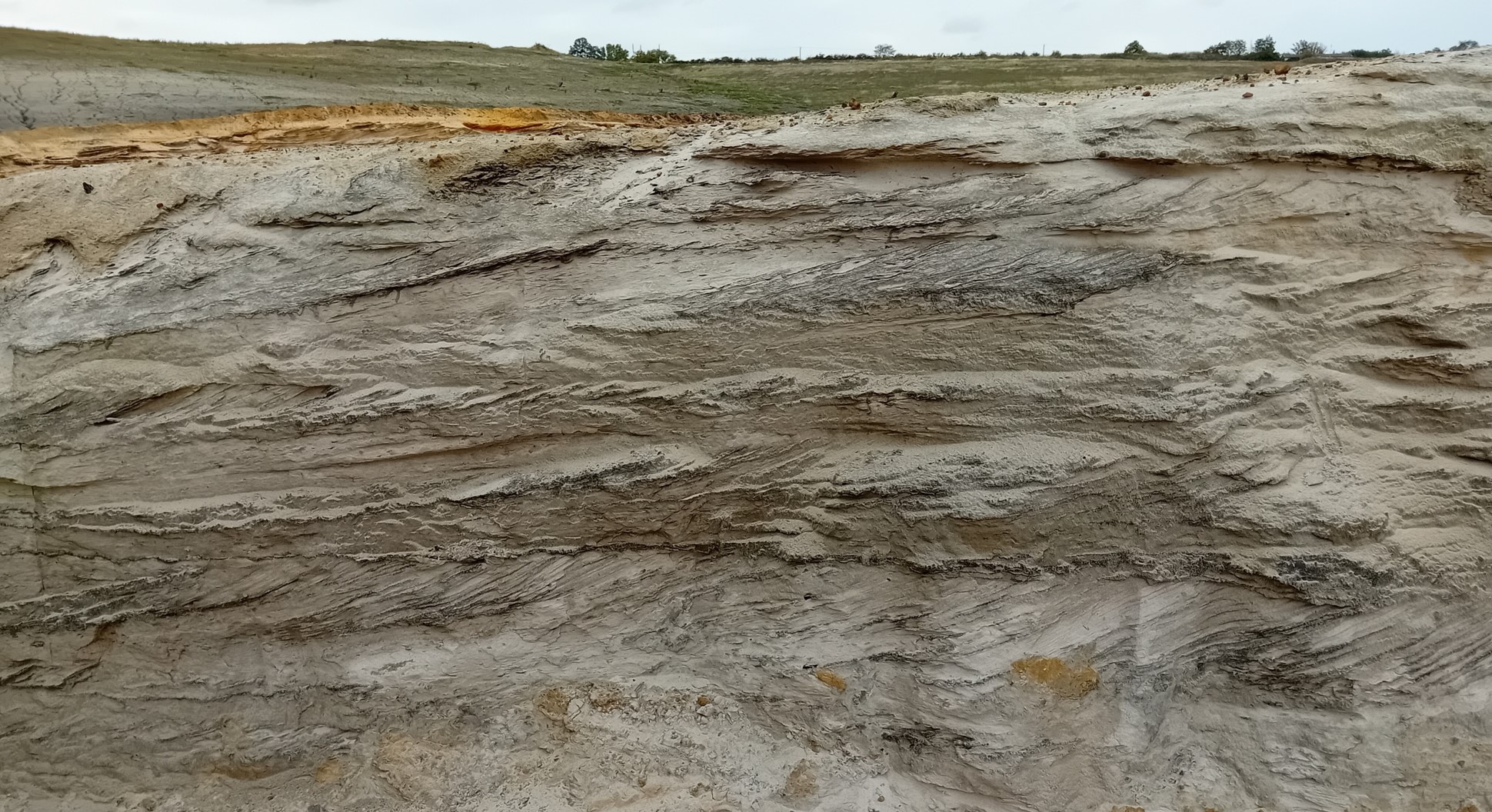
This hands-on course enables attendees to enhance their skills and critically evaluate all aspects of hydrocarbon charge, including source presence, maturation, migration, commodity type and timing. Lectures and exercises focus on characterization and prediction of hydrocarbon charge adequacy using core, well log and seismic data. Global examples, cover a range of basin and depositional settings, will be discussed and used in the exercises.


Duration and Logistics

Classroom version: A 3-day course comprising a mix of classroom lectures and discussion (50%), and hands-on exercises with subsurface datasets (50%). The lecture materials will be provided in digital format and participants will be required to bring a laptop or tablet computer to follow the lectures and exercises. Exercises manuals will be printed for each student to enhance learning by interpreting using pencil on paper.


Level and Audience

Fundamental. This course is intended for geoscientists, reservoir engineers and petrophysicists who want to understand the basic concepts of petroleum systems.


Objectives

You will learn to:

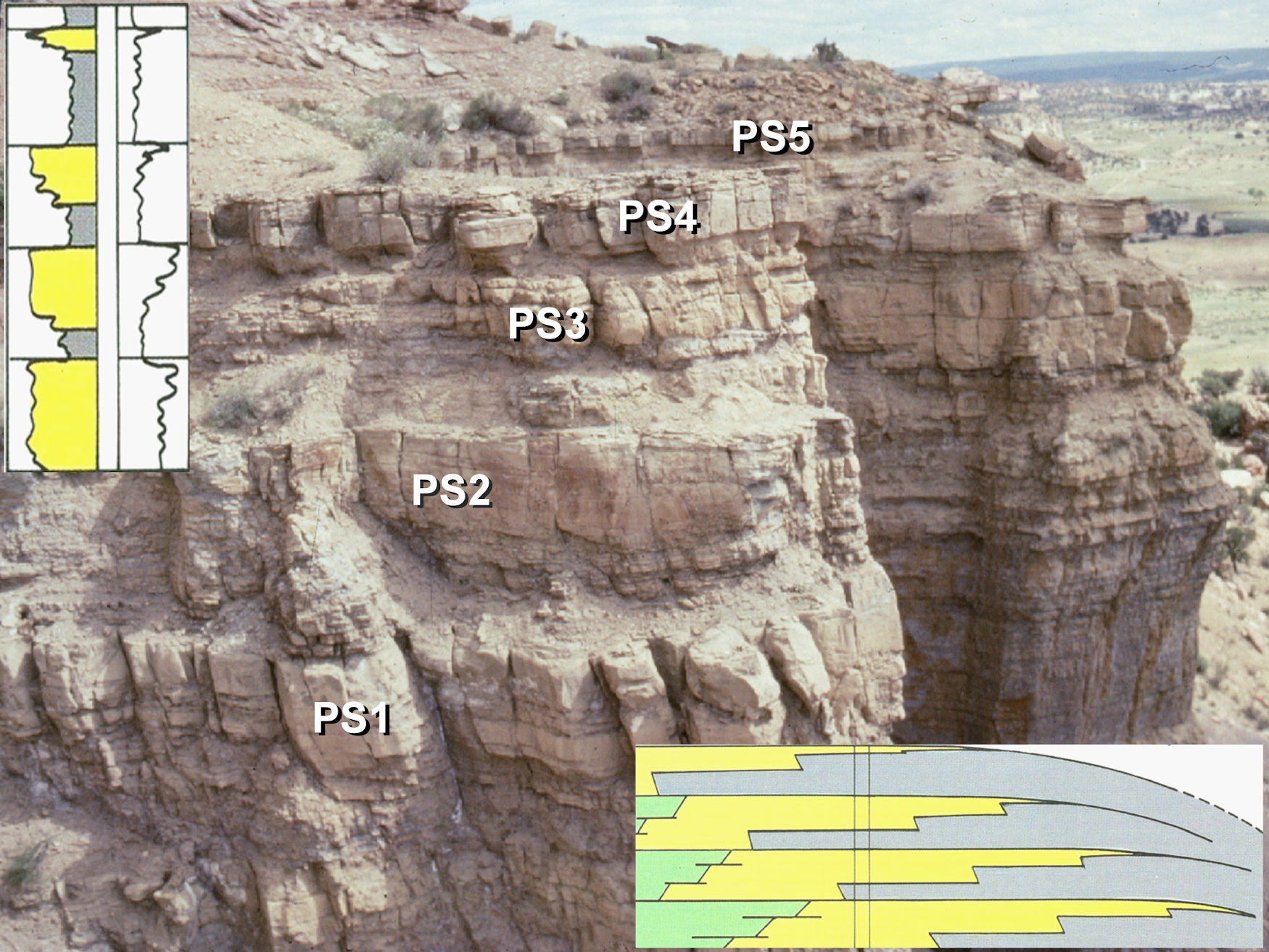
  1. Characterize source rock presence from cores, well logs and seismic and learn to predict source adequacy and risk from first principles.
  2. Understand the controls on source rock maturation and describe fundamental controls on maturation and maturation timing using burial history charts.
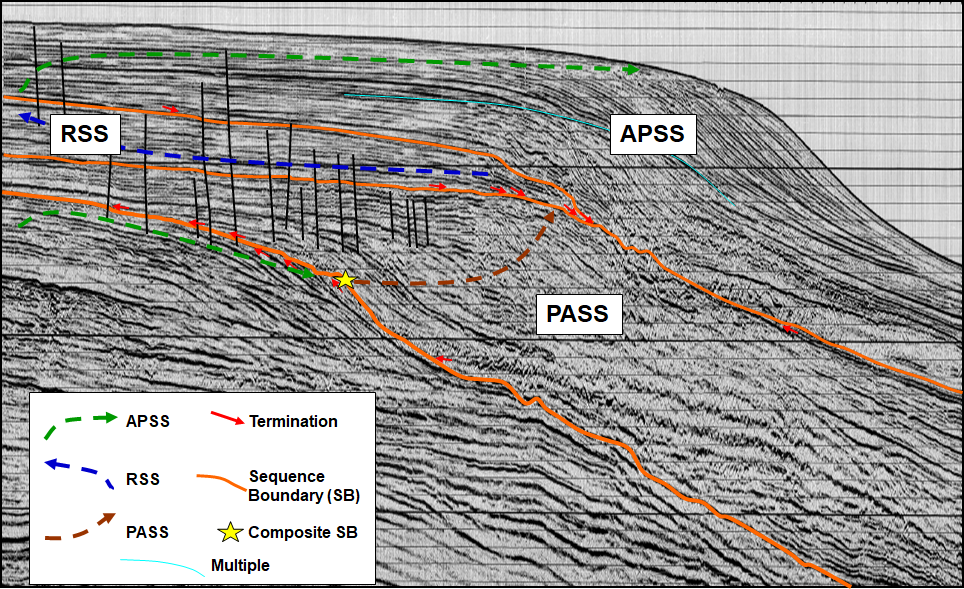
  3. Assess the fundamental controls on hydrocarbon migration and apply the principles of primary and secondary migration to predict hydrocarbon charge pathways and risk migration adequacy for plays and prospects.
  4. Assess commodity implications from source rock type and maturity.

Basin-Scale Stratigraphy (Source-to-Sink): Basins of the Pyrenean Foreland, Spain (G117)

Tutor(s)

Rene Jonk: Director, ACT-Geo Consulting and Training; Honorary Professor, University of Aberdeen.

Overview

Well-exposed outcrops of the Pyrenean Foreland Basin (PFB) in northern Spain offer a unique opportunity for source-to-sink analyses across thrust and foreland basin settings. This course demonstrates regional linkages of continental to marine environments and teaches fundamentals of play-scale reservoir, source and seal mapping and prediction. We utilize 3D outcrop models, detailed biostratigraphic data and subsurface examples to enhance learning through making maps and predictions. The course presents sequence stratigraphic models across continental, shelfal and deep-water settings in order to understand the external controls on sediment flux from the proximal to distal environments.

Duration and Logistics

A 6-day field course, based in the Pyrenees, with the itinerary dependent on the technical objectives of the group and timeframe. 60-80% of the time will be spent in the field, making active observations and undertaking field exercises, in combination with some classroom exercises and lectures as well as the option for viewing core.

Level and Audience

Intermediate. The course is specifically designed for reservoir engineers, geologists and geophysicists interested in analysing a range of clastic reservoir types from a variety of depositional settings. The field course will examine the reservoir attributes of a wide range of sand-prone deposits focusing on the reservoir quality and property distribution as well as larger scale correlation and gross architecture of distinct stratigraphic units. In addition, play-scale prediction of reservoir, source and seal elements will be covered and play-based evaluation techniques will be discussed and practiced.

Exertion Level

This class requires an EASY exertion level. Access to the outcrops is easy with many being road cuts. The longest walk is approximately 3 km over scrubby land. The field area sits at an altitude of up to 1000 m and the weather can be warm with daily highs over 25 degrees Celsius.

Objectives

You will learn to:

  1. Review facies associations in siliciclastic depositional systems.
  2. Predict external controls on sediment flux from continent to basin.
  3. Study the effects of compressional tectonics and the interaction of tectonics and sedimentation.
  4. Assess proximal to distal environments of deposition (EoD) and link them in space and time.
  5. Employ sequence stratigraphic models to continental, shelf and deep-water settings.
  6. Build stratigraphic frameworks across various scales and EoD.
  7. Predict occurrence of basin-scale play elements.
  8. Place local interpretations into regional context for predictions away from well control.
  9. Examine where sediment is stored in shelf environments, as well as when and how sediment is transported to deep water.

An Introduction to Sequence Stratigraphy (G068)

Tutor(s)

Gary Hampson: Professor of Sedimentary Geology, Imperial College London.

Overview

Sequence stratigraphy is a key tool for subsurface interpretation of depositional systems and thereby predicting the distribution of reservoir, source rock and seal lithologies. The course will introduce the principles and methods of sequence stratigraphy, with a focus on continental, shallow-marine and deep-marine depositional settings. Participants will apply these principles and methods via the sequence stratigraphic interpretation of subsurface data (e.g. seismic, well-log, core, reservoir production data).

Duration and Logistics

Classroom version: 2 days including a mix of lectures and exercises. The course manual will be provided in digital format and participants will be required to bring along a laptop or tablet to follow the lectures and exercises.

Online version: Three 3.5-hour interactive online sessions presented over 3 days. A digital manual will be distributed to participants before the course.

Level and Audience

Fundamental. This course is designed for junior geoscientists working on a variety of subsurface energy projects who want to gain a basic understanding of sequence stratigraphy and its applications to subsurface data sets. Participants should have knowledge of basic sedimentology and subsurface geology.

Objectives

You will learn to:

  1. Understand the basic terminology of sequence stratigraphy.
  2. Describe the key surfaces and systems tracts.
  3. Appreciate the main components of depositional sequences in continental, shallow-marine and deep-marine systems.
  4. Evaluate a range of subsurface data in terms of sequence stratigraphic methods and models.

Prospect Generation, Assessment and Risking (G026)

Tutor(s)

Rene Jonk: Director, ACT-Geo Consulting and Training; Honorary Professor, University of Aberdeen.

Overview

This hands-on course enables attendees to enhance their mapping skills and their critical evaluation of prospects. This course demonstrates how to use play fairway mapping and petroleum system analyses to identify plays and prospects with high potential, even in areas with limited data. Once participants identify prospects, the course outlines how to derive geologically map based, objective inputs for prospect assessment and risking. This stepwise approach creates well-documented results that are used to confidently rank opportunities and make smart business decisions.

Duration and Logistics

Classroom version: 5 days; a mix of classroom lectures and discussion and exercises. The manual will be provided in digital format and participants will be required to bring a laptop or tablet computer to follow the lectures.

Level and Audience

Fundamental. This course is intended for early career geoscientists, reservoir engineers and petrophysicists.

Objectives

You will learn to:

  1. Recall play element definitions and hone mapping skills.
  2. Understand tectonic phases and play types with respect to the history of basin evolution.
  3. Interpret and integrate well and seismic data.
  4. Undertake subsurface mapping of prospects and maturation to drillable status.
  5. Risk and rank prospects.
  6. Identify and assess risks and uncertainties related to geological factors (source, reservoir, seal, trap and preservation).
  7. Evaluate prospect success.

Geology for Non-geologists (G088)

Tutor(s)

Jonathan Evans: Director, GeoLogica; Chair of Trustees, Lyme Regis Museum.

Overview

The aim of this course is to provide an overview of the fundamental geological topics relevant to the modern energy industry. Focus will be placed on petroleum geoscience and the basics of petroleum exploration, but the course will also cover geothermal systems, carbon capture and storage, and hydrogen energy.

Duration and Logistics

Classroom: A 2-day course comprising a mix of lectures, case studies and exercises. The manual will be provided in digital format and participants will be required to bring a laptop or tablet computer to follow the lectures and exercises.

Virtual version: Four 3.5-hour interactive online sessions presented over 4 days. Digital course notes and exercises will be distributed to participants before the course.

*A day in the field can be included where logistics allow, to observe a variety of rock types and for participants to gain a better understanding of key geological themes.

Level and Audience

Fundamental. The course is largely aimed at non-geologists who are interested in knowing more about the fundamentals of geology and how these relate to the modern energy industry.

Objectives

You will learn to:

  1. Describe the fundamental principles of geology, including different rock types, geological time and stratigraphy.
  2. Understand the basics of petroleum geoscience, including the formation of oil and gas.
  3. Review the different types of reservoir rocks and their properties, including porosity and permeability.
  4. Recognize how we search for oil and gas, including using seismic and other data.
  5. Understand how we drill for oil and gas and how we acquire information from wells, such as log and core data.
  6. Recognize what technical staff in companies do and how they work together.
  7. Describe the basic principles of carbon capture and storage and how it is being adopted worldwide as a climate change mitigation tool.
  8. Understand the basics of geothermal energy, what it is and how it can be used.
  9. Appreciate how hydrogen energy can be used and stored underground.
 

Plays, Prospects and Petroleum Systems, Wessex Basin, Dorset, UK (G054)

Tutor(s)

Jonathan Evans: Director, GeoLogica; Chair of Trustees, Lyme Regis Museum.

Overview

This course will illustrate the processes of play analysis and prospect evaluation using the geology of the Wessex Basin and outcrops of the Jurassic Coast of Devon and Dorset. The course will assess the elements of a working petroleum system including reservoir, source, seal and trap in the context of the Wytch Farm oilfield. Participants will have the opportunity to study a wide range of clastic and carbonate depositional systems, in addition to varying structural concepts, and visit two producing oil fields.

The manual will be provided in digital format and you will be required to bring a laptop or tablet computer to the course.

Duration and Logistics

A 5-day field course comprising fieldwork (70%) and classroom exercises (30%). The course will be based in Weymouth and transport will be by coach.

Exertion Level

This class requires an EASY exertion level. Outcrop access is easy with short walks of 1-2 km mostly across sandy beaches. Some field stops have more irregular terrain, in the form of pebbly and rocky beaches.

Level and Audience

Fundamental. The course is intended for junior-mid level geoscientists who are working in exploration as well as development and want a broad overview of key petroleum systems concepts or the chance to revise the key themes. The course would also be of value to reservoir engineers wanting to appreciate the role of, and subsurface data analysed by, the geological team.

Objectives

You will learn to:

  1. Understand the elements required in a working petroleum system and the concept of play analysis.
  2. Create play fairways maps based on fieldwork and published data.
  3. Examine the process of prospect evaluation and volumetric assessment including probability of success.
  4. Rank prospects based on the different play elements.
  5. Perform simple resource assessment and exploration risk analysis.
  6. Identify source rocks, how they form and what makes a good source rock.
  7. Compare different reservoir rocks, including sandstones and chalk, to work out how they were deposited and what controls the key reservoir properties of porosity and permeability at different scales.
  8. Describe different seals and flow barriers both above and within the reservoir intervals.
  9. Work with different types of subsurface data, as part of a team, and measure what scale of information they provide e.g. seismic, well logs, core, well tests, production tests.
  10. Analyse a series of local prospects and establish the geological chance of success.
  11. Assess the stages of a subsurface project from exploration through to development and production.
  12. Appreciate the different drilling and production technology in relation to the different reservoir types and project requirements.

Integrating Teams on the Rocks of the Wessex Basin, Dorset, UK (G056)

Tutor(s)

Jonathan Evans: Director, GeoLogica; Chair of Trustees, Lyme Regis Museum.

Overview

Proper integration of teams and disciplines is increasingly important in the modern energy industry. Ensuring all staff, technical, managerial and non-technical, understand the roles, concepts and language used by various disciplines as well as their requirements for data is critical for cooperation, collaboration and business success. This short course uses field observations and discussion at outcrops within the Wessex Basin to facilitate a deeper understanding of others’ roles as well as providing a refresher/reminder of the fundamental importance of rocks and the data they can provide to energy provision. The Wessex Basin provides a classic example of a working petroleum system with easily accessible outcrops to illustrate source rocks, reservoirs and trapping structures. In addition, the area also provides insights into new energy and carbon reduction methods that rely on a solid understanding of the subsurface.

Duration and Logistics

A 2-day field course in Dorset. For in-house provision the course can be extended or shortened depending on a company’s requirements.

Exertion Level

This class requires an EASY exertion level. Hikes are generally 1-2 km in length, on sandy and rocky beaches, coastal paths and with some irregular terrain.

Level and Audience

Fundamental. The level of the trip however, can be tailored to cater for the target audience: subsurface teams, integrated project teams or raising awareness for a generalist audience.

Objectives

Your team will learn to:

  1. Appreciate what elements are required for a working Petroleum System.
  2. Identify source rocks, how they form and what makes a good source rock.
  3. Compare different reservoir rocks, including sandstones and chalk, to work out how they were deposited and what controls the key reservoir properties of porosity and permeability at different scales.
  4. Understand what different types of subsurface data measure and what scale of information they provide e.g. seismic, well logs, core, well tests, production tests.
  5. Describe different seals both above and within the reservoir intervals.
  6. Understand the Petroleum Geology of the Wessex Basin including the giant Wytch Farm oilfield.

Applied Sequence Stratigraphic Analysis of Well Logs (G014)

Tutor(s)

Jeff May: Geological Consultant; Affiliate Faculty, Colorado School of Mines.

Overview

This course offers a practical approach to the sequence stratigraphic analysis of well logs. Lectures and exercises introduce the concepts and terminology of sequence stratigraphy and then apply them to the interpretation and correlation of well logs. Exercises are used to identify significant chronostratigraphic surfaces on well logs and then use the surfaces to construct log correlation sections for a variety of depositional settings. The approach allows for subdividing stratigraphic intervals into meaningful genetic packages, in order to interpret depositional histories and build geologically meaningful maps. Participants will develop the skills necessary to identify and predict new prospects and better subdivide reservoirs.

Duration and Logistics

A 5-day classroom course comprising a mix of lectures (30%), exercises (40%) and core examination (30%). The course is delivered at the Colorado School of Mines in Golden, Colorado, allowing participants access to the school’s inventory of cores. The manual will be provided in digital format and you will be required to bring a laptop or tablet computer to the course.

Level and Audience

Fundamental. This course is aimed at geoscientists to teach them how to interpret well log data, make well-to-well correlations and generate maps in a sequence stratigraphic framework. The content is also suitable for professionals who work with geoscientists, such as petrophysicists and reservoir engineers.

Objectives

You will learn to:

  1. Apply the terminology of sequence stratigraphy.
  2. Identify sequences, systems tracts, sequence boundaries, marine regressive and transgressive surfaces of erosion, and flooding surfaces.
  3. Apply sequence stratigraphic principles in carbonate, continental, shallow marine, deep marine and shale environments.
  4. Generate well-log correlations using sequence stratigraphy concepts and contrast lithostratigraphic and chronostratigraphic correlations.
  5. Apply reservoir-seal-source rock concepts to sequence stratigraphic interpretations.
  6. Create maps of genetically related sequence stratigraphic units.
  7. Predict new stratigraphic prospects or previously untapped reservoir compartments.
  8. Assess the influence of chronostratigraphic surfaces on reservoir quality and flow units.

Sequence Stratigraphy of the Permian Basin, Texas and New Mexico (G002)

Tutor(s)

Rene Jonk: Director, ACT-Geo Consulting and Training; Honorary Professor, University of Aberdeen.

Overview

This field course is designed for geoscientists and engineers exploring and developing plays in mixed carbonate-siliciclastic systems; it is relevant to those working in the Permian Basin. The course will enhance each participant’s ability to distinguish depositional facies and play elements, based on seismic features, stratal geometries, sequence stratigraphy, diagenetic changes impacting reservoir quality and depositional models. Subsurface data from the Permian Basin, including seismic, well logs and cores, will be used to establish a sequence stratigraphic framework for the basin, with emphasis on the prediction of play element presence and quality, both for conventional and unconventional resources, including discussions on production behavior and strategies.

Duration and Logistics

A 5-day field course; a mix of field activities (60%) and classroom lectures and exercises (40%), with long days (typically 10 hours). The course begins and ends in El Paso, Texas. The first night is spent in El Paso; subsequent nights are spent in Carlsbad, New Mexico.

Level and Audience

Advanced. This course is intended for geoscientists, petrophysicists, engineers and managers who are seeking a comprehensive examination into the seismic stratigraphy of the Permian Basin.

Exertion Level

This class requires a MODERATE exertion level. Fieldwork is in west Texas and southeast New Mexico, where the weather is arid and usually hot, although cold and wet weather is possible in the spring and fall when daily temperatures range from 5–25°C (40–80°F). The course includes walks of a moderate length (up to 3.2km/2 miles) with an ascent of 305m (1000 ft), frequently over very steep and uneven ground. Transport on the course will be by mini-van. Most of the driving is on black-top roads, with some driving on graded dirt roads.

Objectives

You will learn to:

  1. Analyze exposures of carbonate shelf and ramp to siliciclastic basinal systems, in order to relate depositional facies to seismic scale geometries and sequence stratigraphy.
  2. Examine seismic scale outcrop geometries, document outcrop facies and demonstrate similarities to productive intervals in the Permian Basin.
  3. Understand how subaerial exposure, marine diagenesis and early near-surface dolomitization can affect ultimate reservoir porosity and permeability and overall reservoir geometry in subsurface.
  4. Assess changes in carbonate facies and relate these changes to depositional environments.
  5. Apply Walter’s Law and chronostratigraphic principles in core, well log and seismic interpretation, and relate to prediction of play elements and best productive intervals for unconventional resources.
  6. Analyze sequence stratigraphy for carbonates and mixed carbonate-clastic depositional systems.
  7. Interpret carbonate sequence stratigraphic patterns from outcrop, well log and seismic data.

Sequence Stratigraphy and its expression on Seismic, Logs and Cores (G001)

Tutor(s)

Rene Jonk: Director, ACT-Geo Consulting and Training; Honorary Professor, University of Aberdeen.

Overview

The application of sequence stratigraphy allows for making geologic interpretations of cores, well logs, seismic and outcrop data within a predictive stratigraphic framework. These predictions can be applied to play and prospect definition and evaluation, pre-drill predictions and discovery appraisal and field development strategies. This course introduces the sequence stratigraphic method and presents workflows and tools to describe, correlate and map strata within a predictive framework using typical subsurface (core, well log and seismic) data. The terminology of surfaces, systems tracts, sequence sets and stratigraphic hierarchy will be described and applied to subsurface data exercises in terrestrial, shallow marine and deep marine depositional settings across clastic and carbonate settings and applied to conventional and unconventional play types. The emphasis will be on the recognition and mapping of play elements (source, seal, reservoir and trap) from exploration to production scales.

Duration and Logistics

Classroom version: A 4-day course comprising a mix of classroom lectures and discussion (50%), and hands-on exercises with subsurface datasets (50%). The lecture materials will be provided in digital format and participants will be required to bring a laptop or tablet computer to follow the lectures and exercises. Exercises manuals will be printed for each student to enhance learning by interpreting using pencil on paper.

Virtual version: Ten 3-hour interactive online sessions presented over 5 days. A digital manual and hard-copy exercise materials will be distributed to participants before the course. Some reading and several exercises are to be completed by participants off-line.

Level and Audience

Intermediate. This course is intended for geoscientists (reservoir modellers, seismic interpreters, sedimentologists), reservoir engineers and petrophysicists who want to understand and apply the concepts of sequence stratigraphy to solve business problems.

Objectives

You will learn to:

  1. Understand the sequence stratigraphic method, terminology and application.
  2. Contrast the various approaches to sequence stratigraphy.
  3. Apply the concept of facies, facies stacking and shoreline trajectories to define sequences, surfaces and system tracts.
  4. Evaluate depositional controls on sequences in non-terrestrial, shallow marine and deep marine environments.
  5. Assess and interpret cores, well logs and seismic lines to characterize and map hydrocarbon play elements in different settings using the sequence stratigraphic method.
  6. Implement sequence stratigraphic methods to predict play element presence, adequacy and risk from seismic data for exploration play and prospect definition.
  7. Apply sequence stratigraphic frameworks to evaluate connectivity in discovery appraisal and field development.
  8. Apply sequence stratigraphic methods to define seal adequacy for subtle and stratigraphic traps in various depositional settings.